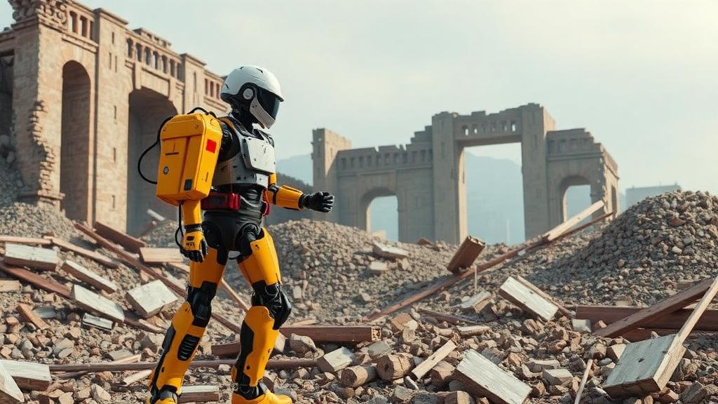
When an earthquake flattens a neighborhood, the first robots sent into the rubble face a paradox that has quietly defined rescue robotics for years: the machines need to share what they see in order to build a common picture of the disaster zone, but the networks they must use are often the very thing the disaster destroyed. A research team led by Lei Ding of Anhui Wenda University of Information Engineering, together with collaborators at Fuyang Institute of Technology, has now unveiled a framework designed to resolve that paradox, allowing a fleet of rescue robots to build a living, four-dimensional map of collapsing ruins while transmitting only tiny, distilled fragments of what they have learned. The study, published in Discover Artificial Intelligence, reports that the system reconstructs disaster scenes with a peak signal-to-noise ratio of 32.58 dB and a structural similarity score of 0.912, renders them at 35.26 frames per second in an offline benchmark, and compresses each federated communication round to just 13.45 megabytes.
The technical foundation of the work is a four-dimensional dynamic Gaussian field, an explicit scene representation that embeds time directly into geometry and appearance. Conventional neural radiance fields and 3D Gaussian splatting produce dense, photorealistic models of static scenes, but they treat the world as frozen. In a post-disaster environment, that assumption fails almost immediately: rubble shifts, debris falls, secondary collapses occur, and dust clouds drift across the sensor field of view. The new framework defines a joint spatiotemporal input vector p = (x, y, z, t), where the normalized timestamp t in [0,1] records the evolution state of the scene. Spatial coordinates are encoded through a multi-dimensional positional hashing mechanism with 16 hash-grid layers whose resolutions increase exponentially, capturing features from coarse to fine, while the time variable is processed by a Fourier feature mapping with 10 frequency bands that projects the low-frequency temporal signal into a high-dimensional space. This combination allows the network to fit high-frequency temporal changes that would otherwise defeat a standard multilayer perceptron.
Each Gaussian primitive in the field carries a time-dependent mean that simulates the trajectory of moving objects, a covariance generated by decomposing a rotation matrix and a scaling matrix, and an opacity that obeys a temporal damping mechanism. The opacity predictor applies an exponential decay factor of the form e^(−λ|t − t_carr|), which reduces the influence of historical frames on present-day reconstruction and prevents temporal aliasing. Pixel colors are synthesized through the volumetric rendering equation, integrating transparency and color information along each ray. The result is a continuous spatiotemporal model that can depict how a scene evolves, rather than a single blurred composite of every moment. In the team’s visual comparisons, a static 3D Gaussian splatting baseline consolidated all geometric states into one representation, producing motion-blurred tails behind falling debris and discontinuous edges along collapsing walls, while the 4D field traced the debris trajectory sharply and rendered semi-transparent dust patterns consistent with the prescribed temporal rules.
Reconstruction quality alone, however, would be useless in a disaster zone if the model were too large to transmit. The explicit representation of 4D Gaussian fields carries a heavy storage burden, and the researchers attacked it with a two-stage compression strategy. The first stage is adaptive Gaussian pruning driven by an importance score that integrates each primitive’s average opacity across viewpoints with its gradient sensitivity, computed as the L2 norm of the loss gradient with respect to that primitive’s parameters through backpropagation. Crucially, the pruning threshold is not fixed. It is recomputed in a closed loop from each robot’s remaining upload-byte budget, which is itself derived from application-layer goodput estimated once per second and smoothed over a five-second exponentially weighted moving window. When the link weakens, the threshold rises, more low-importance Gaussians are removed, and the transmitted payload shrinks to fit the measured carrying capacity of the channel.
The second compression stage is knowledge distillation. A teacher network, a complete 4D Gaussian field predictor with exactly 637,691 trainable parameters spread across eight hidden layers of width 256, transfers its knowledge to a student with four hidden layers of width 80 and exactly 57,611 trainable parameters, which is 9.03 percent of the teacher’s predictor size. The distillation loss combines three terms: a reconstruction task loss, a feature-alignment loss that measures the Euclidean distance between rasterized intermediate feature maps of 64 channels rendered with identical cameras, timestamps, visibility masks and alpha-compositing weights, and a Kullback-Leibler divergence term that treats the intermediate feature vectors as unnormalized logits, softens them with a temperature parameter and matches the resulting channel probability distributions. Both branches share a single 276-dimensional spatiotemporal code, 256 spatial dimensions from the hash grids and 20 temporal dimensions from the Fourier mapping, so the student inherits the encoder’s expressive power without duplicating it. Ablation tests showed that removing distillation dropped the offline rendering rate from 35.26 to 24.18 frames per second, while removing adaptive pruning inflated the per-round communication payload from 13.45 to 44.82 megabytes for a gain of only 0.31 dB in reconstruction accuracy.
Collaboration among the robots is orchestrated through an improved federated averaging mechanism that keeps every raw observation on the robot that collected it. In the reported experiments, eight independent observation areas from the 3DAeroRelief benchmark were mapped one-to-one to eight federated clients, with zero percent overlap or duplication of images, rays, points or temporal frames between them. Statistical heterogeneity was quantified using Earth Mover’s Distance between each client’s semantic histogram and the global one, yielding a mean of 0.287 with a standard deviation of 0.074, a moderate-to-strong non-IID regime that mirrors the spatially separated viewpoints of real rescue robots. To counter the client drift that such heterogeneity induces in standard federated averaging, the server aggregates the global model using dynamic weights proportional to each robot’s normalized bandwidth and battery status, with equal exponents of 1.0 for communication and energy constraints. Robots with good connectivity and sufficient power contribute more strongly to each aggregation, preventing slower nodes from hindering overall progress.
The convergence results are among the most striking in the study. Under the same client partition, participation schedule and initialization protocol, the proposed framework converged in 42 rounds, whereas a Dynamic NeRF baseline combined with standard federated averaging required 126 rounds, a 66.67 percent reduction attributable to the dynamic weighting and periodic synchronization strategy. Each client performs 10 local stochastic gradient descent steps with a learning rate of 0.01 between aggregation events, and convergence is declared when the relative change in global loss falls below 10^-4. The team also stress-tested the communication layer with synthetic weak-link profiles varying between 0.8 and 2.0 Mbit/s with 80 to 200 ms round-trip delay and 1 to 3 percent packet loss, a sudden-drop profile that cut the link tenfold for 60 seconds, and a hard-outage profile that severed it completely for 90 seconds. During disconnections, robots continued local mapping and optimization while the server aggregated the reachable clients; after reconnection, each robot downloaded the latest global model before uploading again, and cached updates older than two server versions were discarded to prevent stale information from overwriting the global model.
The experimental substrate deserves careful attention. The 3DAeroRelief dataset, built by the BinaLab team at Lehigh University, provides real registered aerial imagery and terrain elevation data from hurricane-damaged areas, preserving the unstructured geometry of actual ruins. The dynamic elements, however, were generated as controlled synthetic augmentations: movable debris clusters identified from semantic labels were assigned deterministic keyframe trajectories, with constant-velocity translation in simple scenes, piecewise-smooth translation with fixed-axis rotation in medium scenes, and nonlinear translation with time-varying rotation axes and gravity-shaped irregular-fall profiles in complex scenes. Three difficulty tiers were constructed within a unified 20 by 20 by 8 meter volume, ranging from a partially collapsed single-story building with five low-speed dynamic elements to a severely damaged multi-story collapse zone with 20 high-speed elements, more than 30 percent visual obstruction and interference from smoke and dust. The authors are explicit that these sequences test temporal reconstruction and correspondence preservation under controlled kinematics, not physically exact collapse prediction, and that the framework has not yet been validated across earthquake, flood or fire scenarios.
The team is equally candid about the limits of its hardware claims. The NVIDIA Jetson Orin NX with 16 gigabytes of unified memory is described as the intended deployment target, but every quantitative result, including the 35.26 frames per second rendering rate, was obtained in a common offline non-Jetson benchmark environment. No verified on-device measurements of PSNR, latency, memory consumption, power draw or thermal throttling are reported, and the complete teacher-student distillation computational graph was never claimed to fit within the device’s memory. The authors also draw a sharp line on privacy: the framework provides data-local federated collaboration, meaning raw sensor frames, point clouds and camera poses never leave the originating robot, but no differential-privacy noise mechanism or privacy accountant was implemented. Transmitted model updates may remain vulnerable to gradient-inversion or membership-inference attacks, and the study claims no formal epsilon-delta guarantee.
Those limitations frame what may nonetheless be a significant step toward a genuinely collaborative rescue-mapping capability. The reported numbers, a 70.35 percent reduction in communication overhead relative to a distillation-based federated baseline, an 8.94 percent PSNR improvement attributable to temporal encoding, and convergence in 42 rounds under moderate-to-strong non-IID conditions, describe a system engineered around the constraints that actually kill rescue-robot deployments: bandwidth, battery and time. The authors point to several future directions, including sliding-window temporal buffers for long missions, online budget estimation from historical throughput, heterogeneous student models matched to different robot hardware, and hierarchical aggregation through edge servers. Until the framework runs on physical robots in earthquake and flood rubble with real sensor degradation, its practical suitability remains a hypothesis supported by architectural compactness and controlled comparative efficiency. But the core idea, that a fleet of machines can teach each other to see a collapsing world in four dimensions while sharing almost nothing raw, is exactly the kind of engineering insight that could decide how fast rescuers find the people the machines cannot reach.
Subject of Research: Artificial Intelligence and Robotics
Article Title: Communication-efficient collaborative 4D mapping via federated temporal Gaussian pruning and knowledge-distilled neural radiance fields for post-disaster rescue robotics
Article References: Ding, L., Hu, Z., Yue, J., & Li, D. (2026). Communication-efficient collaborative 4D mapping via federated temporal Gaussian pruning and knowledge-distilled neural radiance fields for post-disaster rescue robotics. Discover Artificial Intelligence, 6(1), Article 1520. https://doi.org/10.1007/s44163-026-02207-x
Image Credits: AI Generated
DOI: 10.1007/s44163-026-02207-x
Keywords: Communication-efficient, collaborative, mapping, federated, temporal, Gaussian, pruning, knowledge-distilled, neural, radiance, fields, post-disaster
News Source: Denise Maddox. (October 17, 2026). Rescue Robots Learn to Map Collapsing Ruins in 4D While Sharing Almost Nothing. Scienmag.