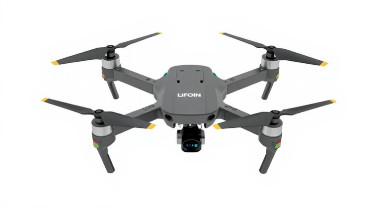
When an earthquake flattens a city block or a landslide buries a hillside road, rescue teams face the same brutal arithmetic: every minute spent searching blind is a minute a survivor may not have. A team of engineers reporting in the open-access journal HardwareX has now documented the complete build of a hexacopter drone designed specifically for that problem, pairing a radiometric thermal camera with a laser-based LiDAR mapping system on a six-rotor airframe that can be replicated from scratch for roughly 73,689 Indian rupees, a figure that translates to well under one thousand US dollars. The platform, named Rapid Response, was designed and flight-tested as an undergraduate research project, and every schematic, firmware file, 3D-printable enclosure and software component has been released under open-source licenses so that other labs, volunteers and disaster-response agencies can rebuild it.
The choice of a hexacopter rather than the more common quadcopter is not cosmetic. With six brushless motors driving six propellers in a Hexa-X layout, the aircraft retains controlled flight even if one rotor fails, a margin of safety that matters enormously when the vehicle is dispatched over rubble, smoke or unstable terrain where a crash means losing both the airframe and the mapping data it carries. The redundant rotor configuration also increases total payload capacity, which is what allows the platform to carry multiple sensing systems at once. In disaster scenarios the aircraft can be deployed quickly without runways or significant ground infrastructure, and its maneuverability lets it thread through confined spaces and reach isolated zones that ground vehicles cannot access. The authors also emphasize the operating economics: small multirotors cost a fraction of larger aerial platforms, making repeated reconnaissance sorties financially realistic for agencies that must monitor an affected area many times over.
The thermal imaging payload centers on the FLIR Lepton 3.5, a remarkably small radiometric thermal camera that measures the actual temperature of every pixel rather than merely rendering a heat picture. The sensor is mounted on a tCam-Mini rev4 breakout board built around an ESP32-WROVER microcontroller with an onboard antenna, an open-source hardware and software design that streams the radiometric data over WiFi to a ground computer. Before flight, the camera’s housing is produced by 3D printing, with four STL components and two copies of a vertical holder printed to form an enclosure that shields the delicate sensor from vibration and mechanical stress during operation. Firmware is flashed to the ESP32 board using Espressif’s serial download tool, loading a bootloader, a partition table and the main tCam firmware in sequence; a dual-color LED confirms a successful boot by briefly turning red and then blinking yellow as the camera begins advertising its own WiFi access point. The companion desktop application then connects to the camera’s default address and displays the live thermal feed, allowing operators to detect human body heat and other thermal anomalies in real time even through smoke, darkness or visual clutter that would defeat an ordinary camera.
The mapping side of the system uses the Garmin LiDAR-Lite V3, a compact and lightweight laser rangefinder chosen for its accurate distance measurements and wide field of view. Because a single fixed sensor sees only one direction at a time, the team mounted it on a pan-and-tilt assembly built from two HS-422 servo motors and an aluminium bracket kit, letting the laser sweep across the terrain below. An Arduino Uno orchestrates the scanning: it toggles the sensor’s enable pin, manages the I2C clock and data lines used for communication, and arbitrates the mode-control pin through parallel resistors to prevent bus contention, all while driving the two servos through PWM signals. As the sensor sweeps, distance readings are transmitted over serial to a ground station, where an open-source interface written in C++ with the OpenGL graphics library converts each measurement into Cartesian coordinates and renders it as a cube whose color encodes angle and distance. The operator can fly through the emerging 3D point cloud while scanning is still in progress, and completed scans can be saved to file and reloaded for later analysis, producing the kind of terrain model that helps responders understand where paths, debris fields and structures lie.
The airframe itself follows a build path that any reasonably well-equipped workshop could follow. Six A2212 brushless motors rated at 1000 KV are bolted to the arms of an F550 hexacopter frame, with their bullet connectors routed through the arms before the electronic speed controllers are positioned. A power distribution board mounted on the lower frame plate feeds all six speed controllers, and every solder joint is tinned with flux to prevent the cold joints that can fail mid-flight. The top plate then encloses the electronics, with the battery carefully balanced along the centerline. An APM 2.8 flight controller with a built-in compass coordinates the six rotors, receiving commands from a Flysky FS-i6X 2.4 GHz transmitter and its ten-channel receiver. The team configured and calibrated the entire flight system using Mission Planner, an open-source ground-control application: firmware for the Hexa X frame is installed over a serial connection, the accelerometer and compass are calibrated by rotating the vehicle until calibration markers clear, the radio sticks are swept to their extremes to record their ranges, and the electronic speed controllers are programmed through a sequence of throttle-position beeps. Anti-vibration dampers sit between the frame and the controller to keep sensor readings clean.
Field validation put the whole assembly through its paces. The team performed pilot testing and initial flight calibrations before moving to full flight and field testing of the integrated platform, confirming aerial monitoring, environmental sensing and real-time wireless transmission of the thermal feed. Wireless transmission tests measured system performance characteristics such as the maximum achievable frame rate for the life-form detection stream, data that defines how quickly an operator on the ground can see a heat signature appear. The platform’s architecture also leaves room for growth: the authors note that the airframe can support a gripper mechanism for object retrieval, temperature and humidity sensors for environmental monitoring, and integration with Geographic Information System databases to sharpen situational awareness during response operations. Multi-sensor fusion of the LiDAR, thermal and environmental streams is presented as the path toward a comprehensive picture of a disaster zone, and the communication module could in principle relay temporary network connectivity into areas where infrastructure has been knocked out.
The build is also refreshingly honest about its limits, several of which will be familiar to anyone who has tried to put serious sensors on a small drone. The single biggest disappointment came during flight testing of the LiDAR: the team was unable to operate the scanner airborne because of the platform’s significant payload capacity and power limitations, a constraint the authors note is common to compact UAV-based LiDAR systems. Continuous LiDAR operation demands sustained laser emission and real-time computation, while the thermal camera needs uninterrupted power for image acquisition, so balancing sensor operation against flight stability and mission duration remains a central engineering challenge. The Garmin sensor itself is also slow: a complete scan yields roughly 92,000 data points, a process that can stretch over several hours when performed thoroughly. On the ground, that is acceptable; in the air, it would be impractical without a faster scanning approach or a lighter, more efficient sensor.
Other constraints are more exotic but no less instructive. The LiDAR’s laser ranging degrades on highly reflective surfaces and transparent materials such as glass, which scatter or pass through the beam rather than returning a clean reflection. Reliable serial communication required fixed-length data strings, so the software pads angular measurements and sensor values with leading zeros, an unglamorous detail that nonetheless determines whether the ground station parses the stream correctly. Perhaps most surprisingly for a civilian disaster tool, the FLIR Lepton 3.5 and certain LiDAR technologies fall under the International Traffic in Arms Regulations, the United States export-control regime for sensitive technologies. Complying with ITAR imposed administrative burdens that affected the project’s timelines, supplier selection and collaboration opportunities, and even sharing LiDAR-derived data with foreign entities required careful legal review. For a low-budget undergraduate project, these regulatory hurdles were as real an obstacle as any engineering problem.
What makes the publication notable is less any single component than the demonstrated end-to-end feasibility of the whole stack. A six-rotor aircraft with rotor-failure redundancy, a radiometric thermal camera that can spot living organisms through conditions that blind optical cameras, a LiDAR system that builds navigable 3D terrain models, and wireless streaming of the thermal data to an operator on the ground were all assembled for a total bill of materials of Rs. 73,689.35, with the single most expensive item, the LiDAR-Lite V3 at Rs. 23,215, costing less than many commercial camera drones on its own. All design files, from the LiDAR schematic and Arduino code to the STL enclosure prints and the tCam-Mini firmware, are archived in Zenodo repositories under Creative Commons and GNU General Public licenses. The authors frame the modular platform as a foundation for continued research in drone-assisted disaster management, with future work pointing toward machine-learning techniques for autonomous navigation that would reduce response times and keep human rescuers out of hazardous zones. For research groups and volunteer response teams in resource-constrained settings, it is a blueprint that turns a disaster-response capability once reserved for well-funded agencies into something a small team can build, fly and improve.
Subject of Research: Low-cost hexacopter platform integrating thermal imaging and LiDAR mapping for disaster management
Article Title: Thermal imaging and LiDAR mapping for disaster management with hexacopter
Article References: Vuucha, H., Jomon, J., Somasundaram, D., & M., M. S. (2026). Thermal imaging and LiDAR mapping for disaster management with hexacopter. HardwareX, Article e00841. https://doi.org/10.1016/j.ohx.2026.e00841
Image Credits: AI Generated
DOI: 10.1016/j.ohx.2026.e00841
Keywords: hexacopter, thermal imaging, LiDAR, disaster management, FLIR Lepton 3.5, Garmin LiDAR-Lite V3, open-source hardware, UAV, search and rescue, ESP32, 3D point cloud, Mission Planner
Cite Scienmag News
APA MLA Chicago
Denise Maddox. (September 25, 2026). Six-Rotor Disaster Drone Pairs Thermal Camera and LiDAR for Under $900. Scienmag. https://scienmag.com/six-rotor-disaster-drone-pairs-thermal-camera-and-lidar-for-under-900/
Denise Maddox. “Six-Rotor Disaster Drone Pairs Thermal Camera and LiDAR for Under $900.” Scienmag, 25 September 2026, https://scienmag.com/six-rotor-disaster-drone-pairs-thermal-camera-and-lidar-for-under-900/. Accessed 25 September 2026.
Denise Maddox. “Six-Rotor Disaster Drone Pairs Thermal Camera and LiDAR for Under $900.” Scienmag. September 25, 2026. https://scienmag.com/six-rotor-disaster-drone-pairs-thermal-camera-and-lidar-for-under-900/
Copy citation Download RIS
Tags: 3D point cloud3D-printable drone componentsaffordable drone for emergency responseautonomous drone safety featuresdisaster managementdisaster response droneESP32FLIR Lepton 3.5Garmin LiDAR-Lite V3hexacopterhexacopter drone for search and rescueLiDARLiDAR technology in rescue missionslow-cost rescue droneMission Planneropen hardware drone projectopen-source drone designopen-source hardwaresearch and rescuethermal camera and LiDAR mappingthermal imagingthermal imaging for disaster zonesUAVUAV for earthquake and landslide rescue