6G’s Green Dividend: Drone Deliveries in China’s Mountains Cut Energy Use by 27% and Carbon by 0.62 kg per Order
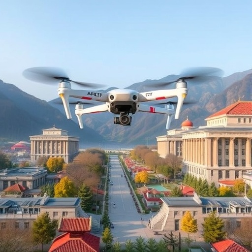
In the mountain fastness of eastern Guizhou, where a delivery van may wind for hours around ridgelines that a drone crosses in minutes, researchers have unveiled one of the most detailed engineering blueprints yet for making low-altitude logistics genuinely green. In a study published 26 August 2026 in the International Journal of Machine Learning and Cybernetics, Ming Dai of the Institute of Applied Artificial Intelligence at Shenzhen Polytechnic University and Huajun Chen and Lina Yuan of Tongren University’s School of Data Science report that rebuilding the region’s drone-delivery network around a 6G space–air–ground integrated architecture cuts the energy consumed by a single delivery sortie by 27.4 percent, trims communication energy by 34.7 percent, and removes 0.62 kilograms of carbon dioxide per order, with the infrastructure repaying its investment in 2.3 years. The study offers an engineering exemplar of the green transformation of China’s fast-rising low-altitude economy.
The policy backdrop matters as much as the physics. China has elevated the low-altitude economy—the commercial use of the airspace just above rooftops, fields and treetops by drones and other aerial vehicles—to the status of a national strategic emerging industry, and eastern Guizhou has emerged as one of its most demanding test beds. The region leverages Tongren Fenghuang Airport for regional connectivity, operates low-altitude tourism routes around the famed peaks of Mount Fanjing, and has begun flying drones that deliver characteristic agricultural products across terrain that punishes ground transport. Guizhou has staked its development strategy on the digital economy, and the province’s carbon-peaking plan for the energy sector sets the emissions backdrop against which any such scheme must be measured. Yet the same mountains that make the airspace commercially attractive also break the technology. The researchers identify three bottlenecks: communication links that weaken badly in complex mountainous topography, where ridgelines shadow transmitters and signals must diffract across kilometers of broken ground; high energy consumption by both aircraft and network infrastructure; and the substantial carbon emissions that follow whenever a battery or base station draws power from a grid with its own carbon intensity.
The team’s central contribution is a construct they call a communication–energy–carbon ternary coupling model, built on the premise that radios, batteries and carbon ledgers cannot be optimized in isolation. The logic is circular and unforgiving. A drone flying through a radio shadow must retransmit control and telemetry packets, inflating the power drawn by its radios; a power-hungry link drains the battery faster, shortening the reach of a delivery sortie; and every kilowatt-hour consumed, whether aloft or in a base station’s amplifier racks, converts into grams of carbon dioxide through a Guizhou regional emission factor. Taking the 6G space–air–ground integrated network as its entry point, the framework couples these domains quantitatively, so that a decision made at the radio layer—tightening a beam, shortening a training sequence—ripples through flight dynamics all the way to the carbon footprint of an individual parcel.
The radio design rests on an ambitious choice of spectrum: the 0.3-terahertz band—300 gigahertz—near the top of what engineers consider usable for mobile communications. Frequencies this high offer vast, largely unoccupied bandwidth, the raw material of 6G’s promised multi-gigabit links, but they are punishing to work with. Free-space path loss climbs with frequency, and molecules of water vapor and oxygen absorb terahertz waves, an attenuation behavior catalogued in International Telecommunication Union recommendations covering 0.1 to 1 THz. Signals survive only as narrow, pencil-like beams that must be aimed with precision, and every degree of misalignment wastes energy. The team’s answer is a low-power beamforming algorithm built on 0.3-THz intelligent metasurfaces—also known as reconfigurable intelligent surfaces—programmable arrays of sub-wavelength elements whose phase responses are adjusted in real time to steer reflections electronically. Because these surfaces reflect and reshape waves rather than amplify them, they can bounce terahertz beams around ridgelines and building facades at a small fraction of the energy cost of active relays, a capability that recent laboratory demonstrations of very-large-scale intelligent surfaces have only begun to make practical.
Around that hardware, the authors layer integrated sensing and communication, or ISAC, a signature 6G capability in which a single waveform simultaneously carries data and performs radar-like sensing. In the study’s architecture, a logistics drone does not merely talk to the network; it localizes itself, senses terrain and obstacles, and supports network management with the same transmitted signal that carries its payload data, eliminating separate sensing hardware and the energy it would consume. The coverage design is explicitly three-dimensional, coordinating beams among drones, terrestrial base stations and satellites—the space–air–ground integration at the heart of 6G blueprints. Base stations anchor the Tongren urban core, aerial nodes extend coverage across valley floors, and satellite links backstop the deepest terrain gaps where terrestrial infrastructure cannot economically reach. The layered design echoes referenced 6G architectures in which low-Earth-orbit satellites assist UAV trajectory and data collection, while high-altitude platform stations loiter above the weather to extend reach. The result is three-dimensional collaborative coverage in which every link holds only as much power as the moment requires, and fast-moving aircraft are handed between narrow, efficient beams without energy-hungry search sweeps.
Validation begins with a digital twin. The team constructed a five-kilometer-by-five-kilometer, three-dimensional topographic channel model of the Mount Fanjing–Tongren urban corridor in MATLAB’s 5G/6G Toolbox, extending standardized stochastic channel models of the kind used in 3GPP engineering—built for frequencies from 0.5 to 100 gigahertz and pushed toward the terahertz frontier—with terrain-aware propagation so that ridgelines, valley walls and buildings shape how signals diffract and scatter. Atop the propagation layer sits a UAV power-consumption dynamics model tracking how propulsion energy varies with speed, climb and hover—a distinction that matters enormously in mountains, where fighting gravity up a canyon drains a battery at rates flat-country simulations never reveal. Air density, wind and terrain-induced turbulence all conspire to raise the energy price of every maneuver. Finally, the Guizhou regional carbon-emission factor closes the loop, converting every kilowatt-hour consumed by rotors or radios into kilograms of CO2. The completed pipeline evaluates emissions with the same rigor as throughput and latency, testing the coupled model end to end before any rotor spins over real terrain.
The commercial proving ground is a logistics park in the Tongren High-tech Zone, for which the authors deliver a network-deployment and energy-optimization package they describe as ready for commercial use. The blueprint pairs infrastructure planning—where to place base stations, metasurfaces and charging points—with an energy-optimization schedule for the drone fleet itself. The headline numbers follow directly from the coupled accounting. Per delivery sortie, energy consumption falls 27.4 percent, the compound result of shorter beam-training sequences, terrain-aware trajectories and metasurfaces that route signals around obstacles rather than overpowering them. Communication energy drops 34.7 percent, because the low-power beamforming algorithm spends far less energy sweeping for moving aircraft and far more holding steady, narrow beams. Scaled across a park’s daily order volume, the savings amount to 0.62 kilograms of CO2 avoided per order—tonnes of carbon as volumes grow. And the economics hold: the authors estimate a payback period of 2.3 years, an unusually short horizon for green infrastructure and likely the number that most interests logistics operators weighing the investment.
Beneath the headline results lies a dense algorithmic substrate. The study’s bibliography traces a lineage running from Dijkstra’s classic shortest-path algorithm and the A* heuristic family to sampling-based motion planners that guarantee near-optimal trajectories, and from there to multiobjective genetic algorithms of the NSGA-II school, which evolve whole populations of candidate network configurations toward Pareto-optimal compromises among conflicting objectives. Recent work on energy-efficient beamforming training in terahertz systems, channel measurements above 200 gigahertz, and metasurface-assisted drone networks supplies the physical building blocks. What distinguishes the new framework is not any single algorithm but the objective function itself: because energy and carbon are wired directly into the communication design, the optimizer cannot bank a radio saving by starving a drone of connectivity, nor shave flight time by squandering hover power against mountain winds. Every candidate configuration is scored simultaneously on communication quality, energy consumption and emissions, and only solutions satisfying all three survive.
The authors are candid about the hurdles between simulation and scale. Terahertz components, including the liquid-crystal phase shifters explored at 0.3 THz, remain laboratory-grade rather than mass-produced, and pencil beams are notoriously fragile—blocked by foliage, degraded by rain and fog, and jostled by airframes rocking in mountain gusts. Very-large-scale reconfigurable intelligent surfaces, the technology underpinning the metasurfaces, have only recently been demonstrated at scale in the laboratory. The team is also unusually concrete about the limits of transparency: its field measurement data are available to other researchers only under a data-use agreement that forbids re-identifying flight locations on airspace-security grounds, and a six-month embargo protects pending patent applications on the metasurface control algorithm—a signal that the researchers view the work as commercially sensitive. Regulators, telecom operators and grid companies, meanwhile, would all need to coordinate before such networks scale beyond a single park.
What elevates the study beyond a regional case study is the template it offers. The low-altitude economy is expanding worldwide—parcel drones over suburbs, sightseeing flights over scenic valleys, agricultural sorties across farmland—and every operator faces the same triad of patchy connectivity, battery anxiety and carbon scrutiny. The Guizhou results suggest that treating communication, energy and emissions as one coupled design problem can yield double-digit savings from the radio network alone, before any improvement in battery chemistry or rotor aerodynamics. The work also quietly rebuts the assumption that green 6G innovation belongs exclusively to coastal technology hubs: the framework was built for fog, valleys and village landing pads, with a regional university supplying terrain-specific knowledge that distant headquarters could not replicate. As the ITU’s IMT-2030 framework nudges 6G from vision toward standardization, the most consequential testbeds may not be in megacities at all, but in places like Tongren—where the mountains make every joule, and every gram of CO2, count.
Subject of Research: A 6G space–air–ground integrated network framework—combining 0.3 THz intelligent metasurfaces, integrated sensing and communication (ISAC), and low-power beamforming, coupled with UAV power-consumption dynamics and a regional carbon-emission factor—to cut energy use and CO2 emissions in drone logistics across the mountainous low-altitude economy of Eastern Guizhou
Subject of Research: Technology and Engineering
Article Title: 6G-empowered low-altitude economy for energy saving and emission reduction: a case study of UAV logistics in Eastern Guizhou
Article References: Dai, M., Chen, H., & Yuan, L. (2026). 6G-empowered low-altitude economy for energy saving and emission reduction: a case study of UAV logistics in Eastern Guizhou. International Journal of Machine Learning and Cybernetics, 17(9), Article 440. https://doi.org/10.1007/s13042-026-03274-3
Image Credits: AI Generated
DOI: 10.1007/s13042-026-03274-3
Keywords: 6G, low-altitude economy, UAV logistics, energy saving and emission reduction, integrated sensing and communication, terahertz communications, reconfigurable intelligent surfaces, beamforming, space-air-ground integrated network, carbon emissions, energy efficiency, UAV channel modeling
Cite Scienmag News
APA MLA Chicago
Denise Maddox. (August 30, 2026). 6G-powered drone logistics in Eastern Guizhou cuts energy use and emissions. Scienmag. https://scienmag.com/6g-powered-drone-logistics-in-eastern-guizhou-cuts-energy-use-and-emissions/
Denise Maddox. “6G-powered drone logistics in Eastern Guizhou cuts energy use and emissions.” Scienmag, 30 August 2026, https://scienmag.com/6g-powered-drone-logistics-in-eastern-guizhou-cuts-energy-use-and-emissions/. Accessed 30 August 2026.
Denise Maddox. “6G-powered drone logistics in Eastern Guizhou cuts energy use and emissions.” Scienmag. August 30, 2026. https://scienmag.com/6g-powered-drone-logistics-in-eastern-guizhou-cuts-energy-use-and-emissions/
Copy citation Download RIS
Tags: 6G drone logistics6G integrated architecture for logistics6G-enabled autonomous drone networkscarbon emission reduction through drone techChina’s green transportation initiativesChina’s low-altitude airspace policydrone delivery blueprintsdrone delivery carbon reductioneco-friendly logistics innovationsenergy savings in drone deliveriesenergy-efficient drone networksenvironmental impact of drone deliveriesenvironmental impact of drone deliverygreen drone delivery in Chinagreen energy savings in mountain deliveriesinnovative engineering in drone logisticsintegrated space-air-ground communication infrastructurelow-altitude economy Chinamountain logistics optimizationmountain region drone logisticssustainable drone transportationsustainable urban air mobility