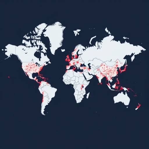
A new global assessment is turning the world’s mobile phone networks into a map of climate risk. Researchers E.J. Oughton, T. Russell, J. Oh and colleagues have examined how telecommunications infrastructure may be exposed to climate hazards, using crowdsourced open data to investigate a problem that is becoming increasingly difficult to ignore: the systems people rely on during disasters may themselves be vulnerable to the disasters they are expected to help manage.
Mobile networks are often treated as invisible utilities, available whenever a phone is switched on. In reality, they are complex physical systems spread across landscapes and borders. Cellular towers, antenna structures, power supplies, backhaul connections, data centers and maintenance facilities must work together continuously. A failure at one point can reduce coverage far beyond the location of the damaged equipment, especially when neighboring sites are overloaded or when backup power is limited.
The study, published in Nature Communications, focuses on the relationship between telecommunications infrastructure and climate hazards at a global scale. Its approach uses crowdsourced open data, a rapidly expanding category of information generated by volunteers, users, mapping communities and publicly accessible platforms. These datasets can include geolocated infrastructure records, observations from affected communities, mapped assets and other location-based information that would be difficult or expensive to collect through conventional surveys alone.
This matters because traditional infrastructure inventories are frequently incomplete, outdated or restricted by commercial and national-security concerns. A network operator may possess detailed information about its own equipment, but researchers and emergency planners rarely have a single, unified view of telecommunications assets across countries. Crowdsourced data cannot automatically solve every gap, yet it can provide an additional layer of visibility, particularly in regions where official records are sparse or where infrastructure is changing rapidly.
The technical challenge is to connect two different kinds of information: where critical communication assets are located and where climate hazards are likely to occur. Hazard data may describe events such as floods, tropical cyclones, wildfires, extreme heat, drought or severe storms. Infrastructure data, by contrast, identifies points, lines or facilities that enable connectivity. By overlaying these datasets in a geographic information system, researchers can estimate exposure—the extent to which an asset is located within a hazard-prone area—without claiming that exposure alone guarantees physical failure.
That distinction is essential. Vulnerability is not simply a matter of placing a tower on a map and finding a flood zone beneath it. The consequences of a hazard depend on elevation, construction standards, drainage, terrain, equipment design, accessibility, redundancy and the availability of electricity. A tower may withstand strong winds while losing service because its power supply fails. A site outside a flooded area may still become unreachable if roads, bridges or fuel deliveries are disrupted. The most serious network failures can therefore emerge from connected chains of damage rather than from a single destroyed structure.
Mobile telecommunications also have a special role during climate emergencies. People use them to receive warnings, contact relatives, request assistance, locate shelters and coordinate rescue operations. Emergency services depend on communications to organize personnel and share information, while governments and humanitarian organizations use mobile channels to distribute instructions and monitor evolving conditions. When networks fail, the loss is not limited to convenience or social media access; it can reduce the speed and reach of emergency response at the moment demand is highest.
The use of open and crowdsourced information could make climate-risk analysis more dynamic. Instead of relying only on static national inventories, researchers may be able to update assessments as new infrastructure is mapped, new hazard data becomes available or communities report local impacts. This creates the possibility of near-real-time monitoring and more targeted resilience planning. It may also help identify places where investment in backup generators, batteries, redundant links, hardened equipment or alternative communication systems could produce the greatest benefit.
At the same time, the approach highlights the limits of data-driven risk maps. Crowdsourced information can contain positional errors, duplicate records, uneven geographic coverage and uncertainties about whether an asset remains operational. Areas with active mapping communities may appear better documented than areas with fewer contributors, creating a misleading impression that risk is lower where information is scarce. Climate projections introduce another layer of uncertainty because future hazards depend on emissions pathways, regional climate behavior and the changing frequency or intensity of extreme events.
The global perspective is therefore less about producing a single, permanent ranking of fragile networks than about establishing a framework for asking sharper questions. Which telecommunications assets are repeatedly exposed to hazards? Where could a local failure trigger regional connectivity loss? Which communities have the fewest alternatives when mobile service disappears? And how can network operators, governments and emergency planners combine technical records with public observations to reduce those risks before the next disaster?
The research arrives as climate change increases pressure on infrastructure designed around historical weather patterns. A tower, switching facility or power system engineered for yesterday’s extremes may face conditions outside its original design assumptions. As heatwaves, floods, fires and storms place simultaneous demands on communications and electricity systems, resilience will increasingly depend on planning for compound events and cascading failures. The study’s central message is urgent: understanding where mobile networks are exposed is a prerequisite for protecting the communications lifelines that modern societies depend on.
Subject of Research: Global vulnerability of mobile telecommunications infrastructure to climate hazards using crowdsourced open data
Article Title: Global vulnerability assessment of mobile telecommunications infrastructure to climate hazards using crowdsourced open data
Article References: Oughton, E.J., Russell, T., Oh, J. et al. “Global vulnerability assessment of mobile telecommunications infrastructure to climate hazards using crowdsourced open data.” Nature Communications (2026). https://doi.org/10.1038/s41467-026-76197-w
Image Credits: AI Generated
DOI: 10.1038/s41467-026-76197-w
Keywords: mobile telecommunications, climate hazards, infrastructure vulnerability, crowdsourced open data, climate resilience, disaster risk, cellular networks, extreme weather, geospatial analysis, emergency communications
Tags: climate hazard vulnerability of mobile networkscomplex physical systems of telecommunication networkscross-border impact of climate-related telecom disruptionscrowdsourced data in climate risk analysisdisaster resilience of telecom systemsglobal mapping of mobile network vulnerabilitiesimpact of climate hazards on cellular towersinfrastructure failure due to climate eventsmobile network vulnerability assessmentopen data for climate hazard assessmentrole of open data in climate hazard mappingtelecommunications infrastructure and climate risk