In the rapidly evolving landscape of agricultural practices, innovative methods are becoming crucial for ensuring food security, sustainability, and resilience, particularly in regions facing environmental and socio-economic challenges. A groundbreaking study led by Belton et al. presents a comprehensive geospatial analysis that facilitates the combined monitoring of poultry and fish farms in Myanmar, a nation beset by fragile economic conditions and environmental vulnerabilities. This work not only highlights the intricate interplay between aquaculture and poultry farming but also establishes a pivotal framework for enhancing food production in similarly challenged regions globally.
Myanmar, with its diverse ecological systems and varying agricultural practices, presents an ideal setting for exploring integrated farming approaches. The country’s significant reliance on agriculture for livelihood and nutrition underscores the necessity for adaptable farming techniques that can withstand climatic fluctuations and market pressures. By leveraging advanced geospatial technologies, the researchers have unearthed new methodologies that offer insights into optimizing farm management practices and maximizing productivity in poultry and fish farming.
One of the notable aspects of this research is its focus on the synergistic interactions between poultry and fish farming systems. Traditionally regarded as separate entities, when integrated, these agricultural practices can create a mutualistic relationship that enhances resource efficiency. For instance, poultry excrement can serve as an organic fertilizer for fish ponds, enriching the aquatic environment and promoting healthier fish growth. Conversely, fish can help manage pests and diseases that may affect poultry, creating a balanced ecosystem that is both sustainable and productive.
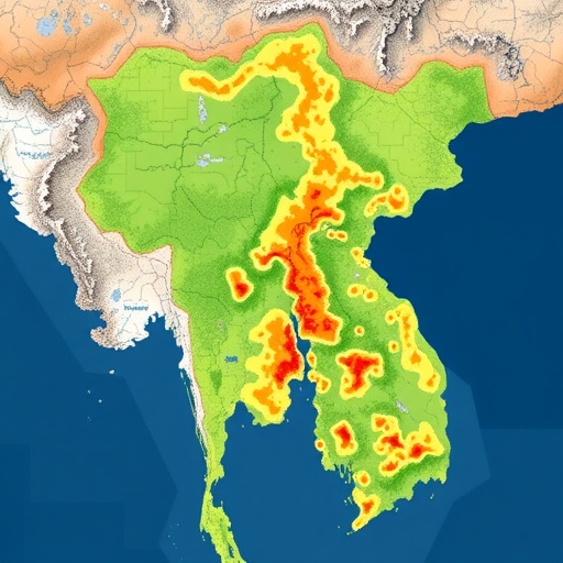
Employing sophisticated satellite imagery and geographic information systems (GIS), the study enables farmers to visualize and analyze the spatial distribution of their farms. This spatial awareness is critical in making informed decisions about resource allocation, crop rotation, and farm layout. By illustrating the interconnectedness of land use patterns, the geospatial analysis assists farmers in identifying optimal locations for their operations, enhancing productivity while minimizing environmental impacts.
In integrating poultry and fish farming operations, the research team highlights the role of community engagement and education. Successful implementation of these integrated farming systems requires the active participation and buy-in from local farmers. The researchers emphasize the importance of training programs that educate farmers about the benefits of such practices, including increased yields, reduced waste, and improved food security. This participatory approach fosters a sense of ownership among farmers and encourages sustainable practices that benefit entire communities.
The implications of this research extend beyond Myanmar’s borders. As climate change continues to threaten global food systems, the strategies employed in this study provide valuable lessons for other regions facing similar challenges. The integration of geospatial technology with traditional farming practices could serve as a model for developing resilient agricultural systems that prioritize sustainability without compromising food production.
Moreover, the study also touches on the economic aspects of integrated farming. The dual production of poultry and fish not only diversifies farmers’ income streams but also enhances their resilience against market fluctuations. By breaking the reliance on a single crop or livestock type, farmers can mitigate risks and adapt to changing market demands, thereby securing their livelihoods and contributing to the broader economy.
The research team also addresses the environmental benefits associated with integrated poultry-fish farming. By maximizing resource utilization and minimizing waste, these systems can decrease the overall ecological footprint of agricultural practices in Myanmar. The reduction of nitrogen and phosphorus runoff from farms into local waterways can lead to improved water quality, not just for fish but for surrounding ecosystems and communities, establishing a more stable environment.
Importantly, this study raises awareness about the vulnerabilities faced by smallholder farmers in Myanmar. As global agricultural practices evolve, it is paramount to recognize and address the unique challenges confronting farmers in fragile states. Policymakers and stakeholders must seek innovative solutions that empower these farmers while promoting food security and ecological sustainability in the face of global challenges.
The researchers’ findings urge immediate action in terms of policy formulation and implementation. To harness the potential of integrated poultry and fish farming, supportive government policies are essential. This includes investment in infrastructure, access to technology, and financial resources that facilitate the transition to more sustainable agricultural practices. Encouraging collaboration between farmers, researchers, and policymakers will be vital in paving the way for adaptation and resilience in the agricultural sector.
In conclusion, Belton et al.’s research presents a transformative approach to farming in Myanmar, emphasizing the potential of geospatial analysis in integrating poultry and fish farming. The multifaceted benefits that arise from this integrated model highlight the need for innovative agricultural practices that prioritize sustainability and resilience, especially in vulnerable regions. As the global population continues to grow and environmental challenges intensify, such comprehensive farming strategies will be essential in creating a sustainable and food-secure future worldwide.
The innovative methodologies outlined in this study warrant further exploration and adaptation in different contexts. As research in this area continues, it is crucial that stakeholders consider the various dimensions of agricultural sustainability, emphasizing technologies that not only enhance productivity but also promote ecological balance and social equity.
With geospatial analysis proving to be a powerful tool in agriculture, the findings of this study hold promise for future research and development initiatives. By fostering a collaborative environment where scientific research meets practical farming applications, there is significant potential to drive positive change in the agricultural sector, ensuring food security and sustainability for generations to come.
Through this research, it becomes evident that integrated farming systems have the potential to revolutionize the way we approach agriculture in fragile states. By recognizing and harnessing the interconnected nature of farming practices, we can build a more resilient and sustainable future.
Subject of Research: Integrated Poultry and Fish Farming in Myanmar
Article Title: Geospatial analysis enables combined poultry–fish farm monitoring in the fragile state of Myanmar
Article References: Belton, B., Fang, P., Liu, S. et al. Geospatial analysis enables combined poultry–fish farm monitoring in the fragile state of Myanmar. Nat Food 6, 664–667 (2025). https://doi.org/10.1038/s43016-025-01192-1
Image Credits: AI Generated
DOI: https://doi.org/10.1038/s43016-025-01192-1
Keywords: Integrated Farming, Geospatial Analysis, Food Security, Sustainability, Poultry, Fish Farming, Environmental Management, Agricultural Innovation
Tags: advanced agricultural technologiesaquaculture and poultry synergyclimate-adaptive farming methodseconomic challenges in Myanmar agricultureenvironmental sustainability in aquaculturefood security in developing countriesgeospatial analysis in agricultureinnovative farming techniques for resilienceintegrated farming systems benefitsoptimizing farm management practicespoultry and fish farming integrationsustainable farming practices in Myanmar


