Credit: Credits: NASA Goddard MODIS Rapid Response Team
Tropical Cyclone Enawo continued to move through central Madagascar on a southern track as NASA's Aqua and Terra satellites gathered imagery and data on the powerful storm.
The AIRS instrument or Atmospheric Infrared Sounder that flies aboard NASA's Aqua satellite provided an infrared look at Tropical Cyclone Enawo over northeastern Madagascar on March 7 at 2141 UTC (4:41 p.m. EST). Infrared data from AIRS measures temperatures and found some cloud top temperatures about 210 kelvin (minus 81.6 degrees Fahrenheit/minus 63.1 degrees Celsius), indicating very strong storms, very high in the troposphere. Storms with cloud tops that high have been shown to generate heavy rainfall.
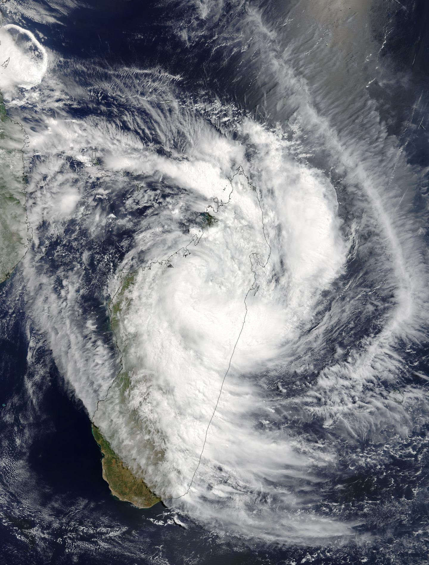
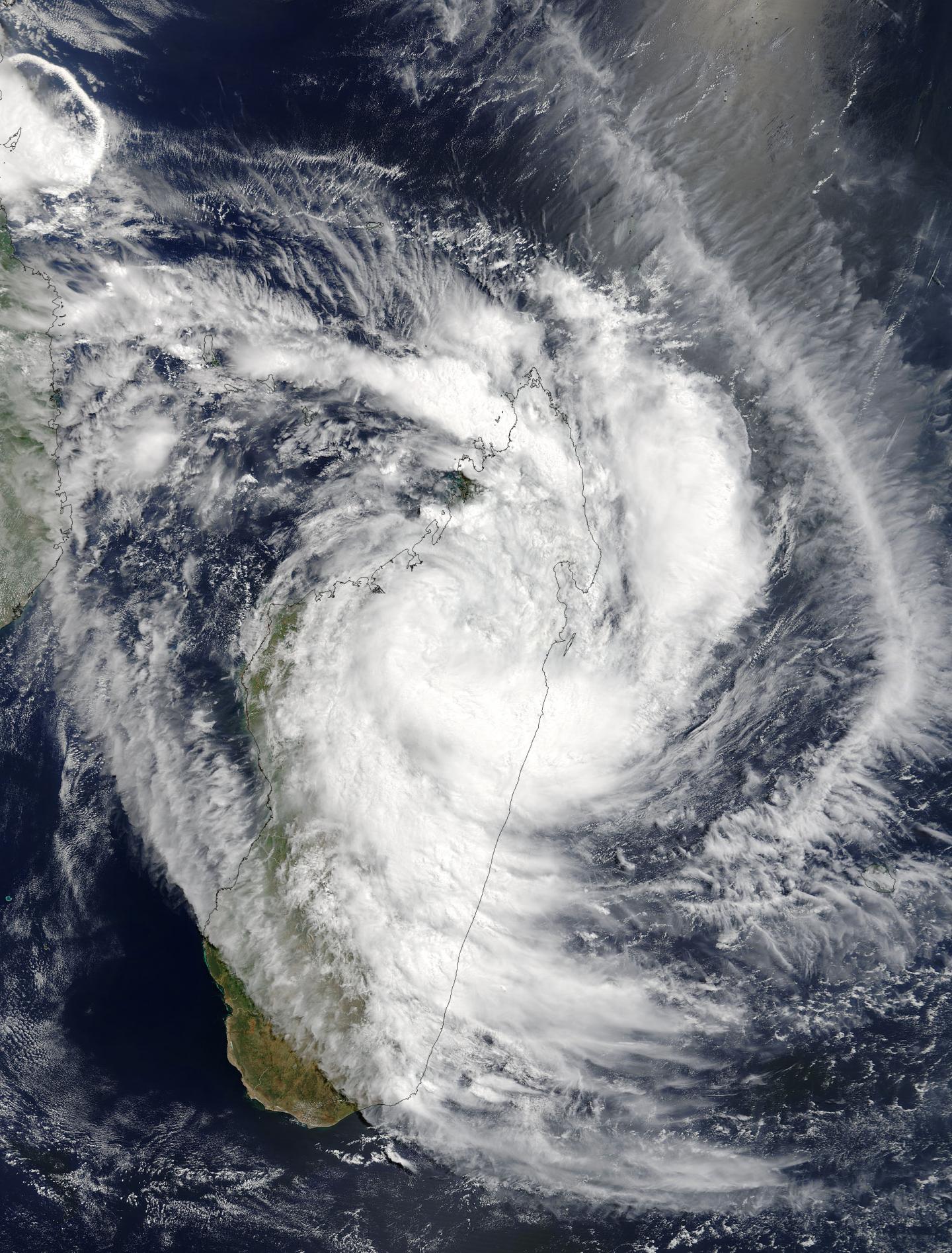
The next day, March 8 at 0710 UTC (2:10 a.m. EST), the Moderate Resolution Imaging Spectroradiometer or MODIS instrument aboard NASA's Terra satellite provided a visible picture of Enawo's clouds. The MODIS image revealed that the center of Enawo was over the north central part of Madagascar near Maevatanana.
At 2100 UTC (4 p.m. EST) on March 7, the Joint Typhoon Warning Center or JTWC issued their final warning on Enawo. At that time, Enawo was located near 15.5 degrees south latitude and 49.2 degrees east longitude, about 459 nautical miles northwest of St. Denis. Enawo was moving to the southwest at 9.2 mph (8 knots/14.8 kph) had maximum sustained winds near 103.6 mph (90 knots/166.7 kph). At that time, the JTWC said "The convective structure has continued to rapidly erode due to the land interaction with the rugged terrain."
The Madagascar Meteorological Services or MMS has issued various warnings on March 8 that include:
A Red Alert or Alerte Rouge is in effect for: Sur Anosibe-Anala, Moramanga, Antanambao-Manampotsy, Marolambo, Mahanoro, Vatomandry, Vohibinany, Toamasina, Manandriana, Fianarantsoa, Ikalamavony, Vohipeno, Ikongo, Manakara-Atsimo, Mananjary, Ambohimahasoa, Nosy-Varika, Ifanadiana, Ambalavao, Fandriana, Ambositra, Ambatofinandrahana, Fenoarivo-Afovoany, Antananarivo-Atsimondrano, Faratsiho, Andramasina, Antanifotsy, Soavinandriana, Miarinarivo, Tsiroanomandidy, Ambatolampy, Betafo, Antsirabe, Anjozorobe, Manjakandriana, Arivonimamo, Ankazobe, Ambohidratrimo, Antananarivo.
A Yellow Alert or Alerte Jaune is in effect for: Sur Benenitra, Amboasary-Atsimo, Bekily, Betroka, Ambovombe-Androy, Taolanaro, Tsihombe, Beloha, Ampanihy, Betioky-Atsimo, Befotaka, Iakora, Ivohibe, Vondrozo, Ihosy, Midongy-Atsimo, Vangaindrano, Farafangana.
A Blue Alert or Alerte Bleue is in effect for: Sur Ambanja, Nosy-Be, Ambilobe, Vohimarina, Antsiranana, Andapa, Sambava, Antalaha, Mampikony, Kandreho, Bealanana, Antsohihy, Befandriana-Avaratra, Analalava, Mandritsara, Port-Berger, Tsaratanana, Mitsinjo, Marovoay, Ambato-Boina, Maevatanana, Soalala, Mahajanga, Soanierana-Ivongo, Andilamena, Vavatenina, Ambatondrazaka, Amparafaravola, Fenoarivo-Atsinanana, Mananara-Avaratra, Maroantsetra, Sainte Marie.
For updated forecasts and warnings from the MMS, visit: http://www.meteomadagascar.mg/cyclone
JTWC said that Enawo will rapidly dissipate over the day and a half due to the impacts of the terrain. The remnant circulation is expected to be absorbed into a mid-latitude cyclone passing south of Madagascar in the Southern Indian Ocean
###
Media Contact
Rob Gutro
[email protected]
@NASAGoddard
http://www.nasa.gov/goddard
############
Story Source: Materials provided by Scienmag


