Credit: Credits: NASA Goddard MODIS Rapid Response Team
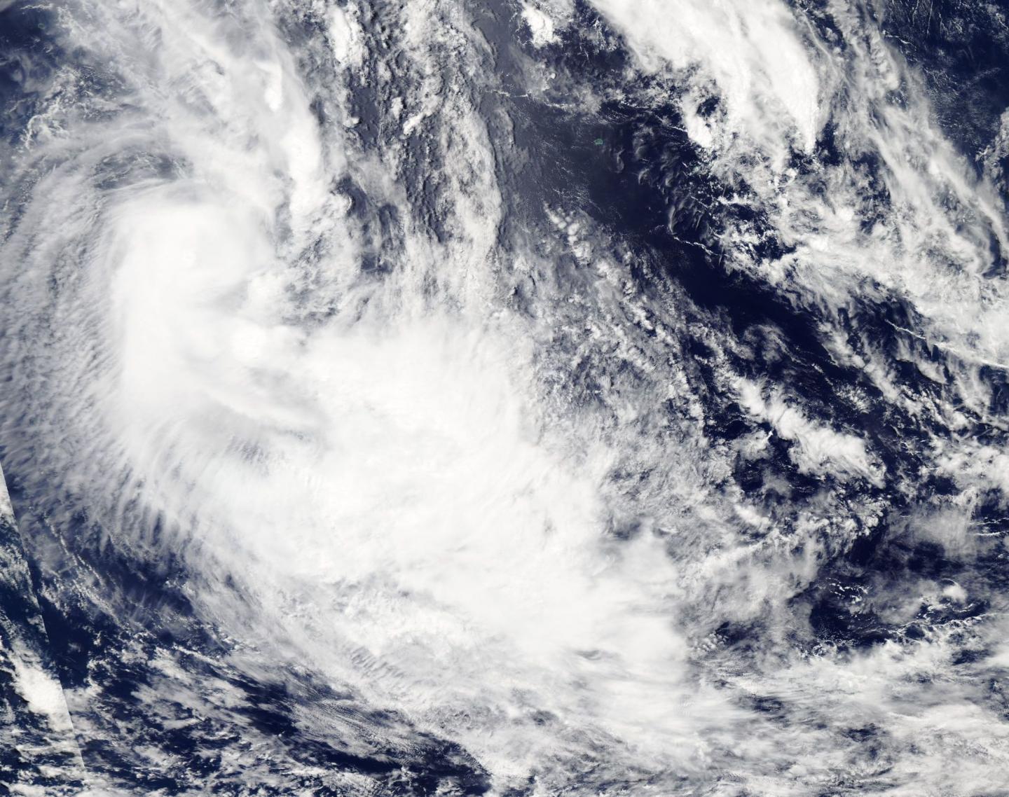
NASA's Aqua satellite spotted Tropical Cyclone 08P as it was developing in the South Pacific Ocean. Tropical Cyclone 08P, or 08P formed east of Extra-tropical cyclone Bart.
Tropical cyclone 08P developed on Feb. 22 at 0300 UTC (Feb. 21 at 10 p.m. EST), and strengthened by 1500 UTC (10 a.m. EST) into a tropical storm with maximum sustained winds near 35 knots (40 mph/62 kph). 08P is expected to maintain strength over the next day as it moves in a southeasterly direction in the South Pacific's open waters. 08P was located near 25.4 degrees south latitude and 165.8 degrees west longitude, about 660 nautical miles south-southeast of Pago Pago, American Samoa. 08P is moving to the southeast at 33 knots (38 mph/61 kph).
Like its predecessor Bart, Tropical Cyclone 08P is also dealing with vertical wind shear despite forming under those conditions.
The MODIS or Moderate Resolution Imaging Spectroradiometer instrument aboard NASA's Aqua satellite took a visible image of the storm on Feb. 21 as it was developing. The MODIS image showed wind shear was pushing the clouds and strongest storms southeast of the low-level center of circulation. The MODIS image also showed that 08P is elongated from northwest to southeast.
The Joint Typhoon Warning Center or JTWC noted that dry air associated with a nearby trough (elongated area of low pressure) is wrapping around the northern quadrant of Tropical Cyclone 08P. JTWC expects 08P to become extra-tropical in a day.
###
Media Contact
Rob Gutro
[email protected]
@NASAGoddard
http://www.nasa.gov/goddard
############
Story Source: Materials provided by Scienmag


