Intense tropical cyclones are one of the most devastating natural disasters in the world due to torrential rains, flooding, destructive winds, and coastal storm surges. New research co-authored by a University of Hawai‘i at Mānoa atmospheric scientist revealed that since the 1980s, Category 4 and 5 hurricanes (maximum wind speed greater than 131 miles per hour) have been arriving three to four days earlier with each passing decade of climate change. Their findings were published recently in Nature.

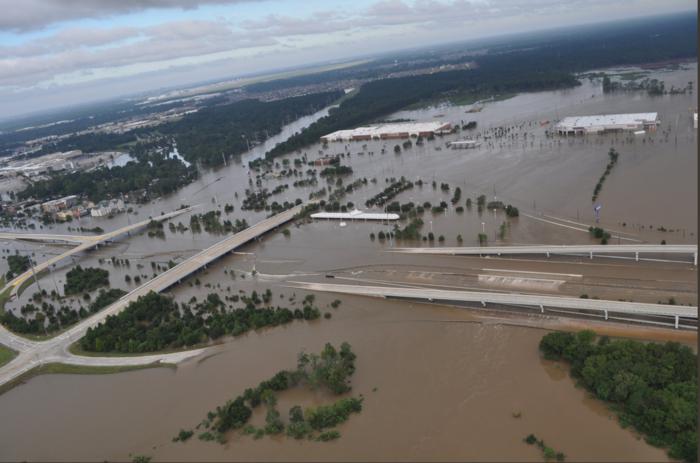
Credit: Harris County Sheriff Office.
Intense tropical cyclones are one of the most devastating natural disasters in the world due to torrential rains, flooding, destructive winds, and coastal storm surges. New research co-authored by a University of Hawai‘i at Mānoa atmospheric scientist revealed that since the 1980s, Category 4 and 5 hurricanes (maximum wind speed greater than 131 miles per hour) have been arriving three to four days earlier with each passing decade of climate change. Their findings were published recently in Nature.
“When intense tropical cyclones occur earlier than usual, they cause unexpected problems for communities,” said Pao-Shin Chu, atmospheric sciences professor in the UH Mānoa School of Ocean and Earth Science and Technology and Hawai‘i State Climatologist. “Moreover, the earlier advance of these storms will overlap with other weather systems, for example local thunderstorms or seasonal monsoon rainfall, and can produce compounding extreme events and strain the emergency response.”
Changes in many characteristics of intense hurricanes under a warming climate, for example, the number, intensity, and lifespan, are fairly well-studied. However, little is known about changes in the seasonal cycle of these intense events.
Using satellite data, historical tropical cyclone tracks, NOAA rainfall records, and various statistical methods, Chu and co-authors found that there has been a significant shift of these intense tropical cyclones from autumn to summer months since the 1980s in most tropical oceans. The effect was particularly observed in the eastern North Pacific off the coast of Mexico, where most hurricanes near Hawai‘i come from; the western North Pacific; the South Pacific; the Gulf of Mexico; and the Atlantic coast of Florida and the Caribbean.
“It was surprising to consistently see earlier arrivals when we independently assessed satellite data and conventional ground-based observations of intense tropical cyclones,” said Chu.
In August 2017, for example, Hurricane Harvey, a Category 4 hurricane, made landfall on Texas and Louisiana and inflicted catastrophic flooding and more than 100 deaths.
Using simulations from multiple global climate models (e.g., high-resolution CMIP6 models), the team detected warmer oceanic conditions developed earlier, which favored the earlier onset of intense tropical cyclones. Further, they found that the warming was primarily driven by greenhouse gas forcing.
“In a future with high carbon dioxide emissions, the earlier shifting trend is projected to be amplified,” said Chu.
In South China and the Gulf of Mexico, the earlier onset of intense tropical cyclones contributes significantly to an earlier onset of extreme rainfall.
“Given the seasonal advance of intense tropical cyclones, as shown in this study, the potential for simultaneous occurrence with other high-impact weather events should be a serious concern for the society,” said Chu. “Understanding potential changes in hurricane activity in response to global warming is important for disaster prevention, resource management and community preparedness.”
Journal
Nature
DOI
10.1038/s41586-023-06544-0
Method of Research
Data/statistical analysis
Article Title
Seasonal advance of intense tropical cyclones in a warming climate
Article Publication Date
27-Sep-2023
COI Statement
The authors declare no competing interests.


