China’s commitment to achieving carbon neutrality takes a significant step forward with the successful collaboration between the Institute of Atmospheric Physics, Chinese Academy of Sciences (IAP/CAS), Harbin Institute of Technology (HIT) and the National Satellite Meteorological Center (MSMC) of China Meteorological Administration. Together, they have made notable progress in solar resource assessment, a critical element for utilizing photovoltaic (PV) energy efficiently.

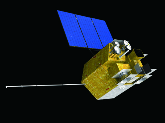
Credit: National Satellite Meteorological Center, China Meteorological Administration
China’s commitment to achieving carbon neutrality takes a significant step forward with the successful collaboration between the Institute of Atmospheric Physics, Chinese Academy of Sciences (IAP/CAS), Harbin Institute of Technology (HIT) and the National Satellite Meteorological Center (MSMC) of China Meteorological Administration. Together, they have made notable progress in solar resource assessment, a critical element for utilizing photovoltaic (PV) energy efficiently.
Utilizing data from the Advanced Geostationary Radiation Imager onboard the Fengyun-4A (FY-4A) satellite, a random forest model, and a physical model chain that converts irradiance to PV power, the team has generated a detailed PV resource map, shedding new light on China’s solar energy potential.
FY-4A, the first of the latest generation of Chinese geostationary satellites, significantly enhances solar resourcing and forecasting with its high-resolution capabilities. GAO Ling from NSMC explains that the satellite’s wider field-of-view has improved the reliability of the current solar radiation product over China compared to using measurements from Himawari or Meteosat satellites, especially towards the edge of the satellite disk.
Prof. XIA Xiang’ao, the corresponding author from IAP/CAS, explains that their work goes beyond conventional global horizontal irradiance (GHI) approaches used in most studies; the team’s research extends to effective irradiance, a crucial factor for precise solar resource assessment for PV applications.
This extension, from irradiance resourcing to PV resourcing, is thought to be a defining characteristic of the latest energy-meteorology-style of solar resource assessment, said HIT professor YANG Dazhi, the co-corresponding author of the paper.
Indeed, what sets this research apart is the integration of a highly advanced workflow known as the physical model chain. By leveraging a sequence of energy meteorology models in cascade, the team achieves remarkably accurate estimates of in-plane irradiance. This innovative approach holds profound implications for the future of solar resource assessment.
The solar PV resource map resulting from this collaborative research is of immense value to stakeholders involved in designing, planning, and operating solar energy systems. The comprehensive insights into China’s solar energy landscape empower decision-makers to make informed choices for a sustainable and green energy future.
The research findings were published in the journal Renewable and Sustainable Energy Reviews. The first author of the paper is Dr. SHI Hongrong from IAP/CAS.
As China progresses towards carbon neutrality, the successful combination of advanced technology and pioneering research embodied by the FY-4A satellite and AI model sets a new standard for solar resource mapping, inspiring positive change in the global pursuit of renewable energy.
Journal
Renewable and Sustainable Energy Reviews
DOI
10.1016/j.rser.2023.113549
Article Title
First estimation of high-resolution solar photovoltaic resource maps over China with Fengyun-4A satellite and machine learning
Article Publication Date
13-Jul-2023


