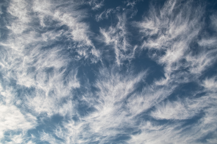
Wind speed and direction provide clues for forecasting weather patterns. In fact, wind influences cloud formation by bringing water vapor together. Atmospheric scientists have now found a novel way of measuring wind – by developing an algorithm that uses data from water vapor movements. This could help predict extreme events like hurricanes and storms.
Credit: None required
Wind speed and direction provide clues for forecasting weather patterns. In fact, wind influences cloud formation by bringing water vapor together. Atmospheric scientists have now found a novel way of measuring wind – by developing an algorithm that uses data from water vapor movements. This could help predict extreme events like hurricanes and storms.
A study published by University of Arizona researchers in the journal Geophysical Research Letters provides, for the first time, data on the vertical distribution of horizontal winds over the tropics and midlatitudes. The researchers got the water vapor movement data by using two operational satellites of the National Oceanic and Atmospheric Administration, or NOAA, the federal agency for weather forecasting.
Wind brings everything else in the atmosphere together, including clouds, aerosols, water vapor, precipitation and radiation, said Xubin Zeng, co-author of the study and the director of the Climate Dynamics and Hydrometeorology Collaborative at UArizona. But it has remained somewhat elusive.
“We never knew the wind very well. I mean, that’s the last frontier. That’s why I’m excited,” Zeng said.
Thanks to more advanced algorithms, Zeng said, the researchers were able to do the estimation of horizontal winds not just at one altitude, but at different altitudes at the same location.
“This was not possible a decade ago,” Zeng said.
Wind measurement typically is done in three different ways, Zeng explained. The first is through the use of radiosonde, an instrumental package suspended below a 6-foot-wide balloon. Sensors on the radiosonde measure wind speed and direction, and take measurements of atmospheric pressure, temperature and relative humidity. The downsides of radiosonde balloons, Zeng said, is the cost. Each launch could cost around $400 to $500, and some regions, such as Africa and the Amazon rainforest, have limited radiosonde stations. The other limitation is that radiosondes are not available over oceans, Zeng said.
Another way to measure wind is using cloud top, which is the height at which the upper visible part of the cloud is located, Zeng said. By tracking cloud top movement using geostationary satellite data, weather experts monitor wind speed and direction at one height. But Zeng said cloud tops exist most of the time below 2 miles or above 4 1/2 miles above Earth’s surface, depending on whether the clouds are low or high. This means wind information is usually not available in the middle, between 2 and 4 1/2 miles.
Lidar, which stands for light detection and ranging, is a method that precisely measures wind movements at different elevations, and it provides very good data, Zeng said. But with lidar, measurements can be acquired only in one vertical “curtain,” with measured wind typically in the east-west direction, he added.
Nowadays, Zeng said, to study topics like air quality and volcano ash dispersion, which are directly influenced by wind, experts use weather forecasting models to ingest measurements from different sources rather than using direct measurements of wind. But model outputs are not good enough when there is rainfall, Zeng said.
In their study, Zeng and his team avoided using data from models. They instead used data from the movement of water vapor recorded by the two NOAA satellites. The satellites moved in the same direction separated by a 50-minute interval, and they detected the water vapor movement through infrared radiation.
While our eyes cannot detect the minute movements of water vapor in the atmosphere, lead study author Amir Ouyed, a member of Zeng’s research group, used machine-learning algorithms that do better image processing to track water vapor.
“For decades, people were saying, ‘You have to move the cloud top or water vapors enough so that you can see the difference of the pattern.’ But now, we don’t need to do that,” Zeng said.
“The resolution of the data is coarse, with a pixel size of 100 kilometers. It’s a demonstration of the feasibility for our future satellite mission we are pursuing where we hope to provide the 10-kilometer resolution,” Zeng said.
Zeng and his collaborators at other institutions are planning to pursue a new satellite wind mission in which they envision combining water vapor movement data and measurements from wind lidar to provide better wind measurements overall.
Journal
Geophysical Research Letters
DOI
10.1029/2022GL101830
Method of Research
Computational simulation/modeling
Subject of Research
Not applicable
Article Title
Global Three-Dimensional Water Vapor Feature-Tracking for Horizontal Winds Using Hyperspectral Infrared Sounder Data From Overlapped Tracks of Two Satellites
Article Publication Date
30-Mar-2023


