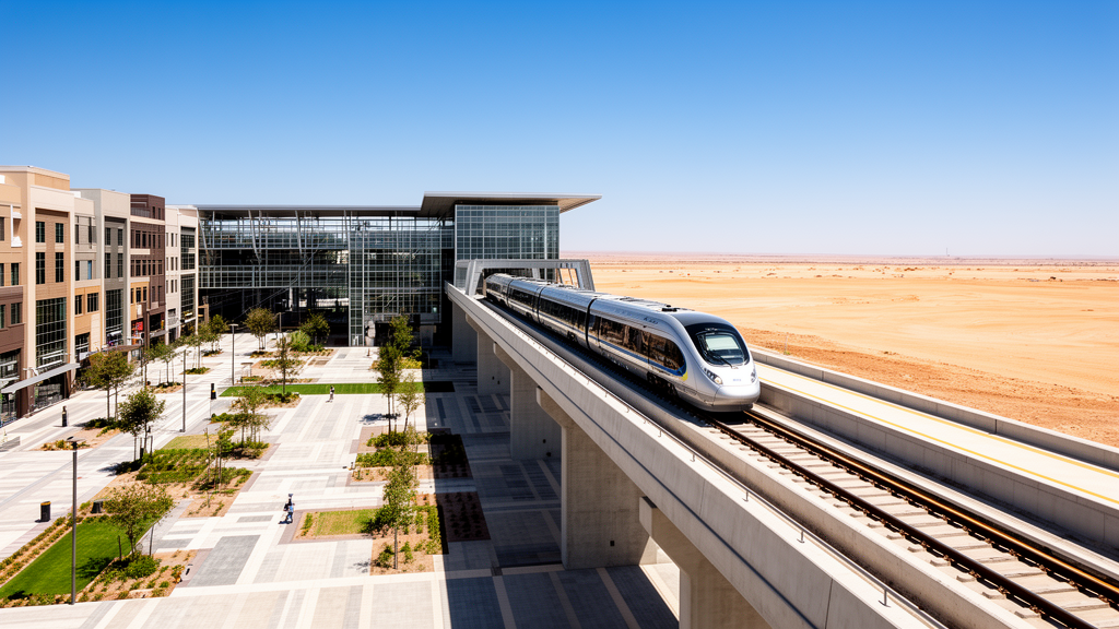
A comparative evaluation of passenger stations along Egypt’s emerging Light Rail Transit corridor reveals substantial disparities in transport connectivity and local spatial conditions, demonstrating that public transport infrastructure alone does not create uniform transit-oriented development conditions. Researchers evaluated station areas connecting El Salam, the New Administrative Capital, and 10th of Ramadan City using an adapted framework combining Node and Place indicators alongside broader alignment with the United Nations Sustainable Development Goals. The empirical investigation established that while established metropolitan interchanges possess strong multimodal links and dense surrounding street grids, stations located within newly developing administrative and suburban zones exhibit far more constrained transport integration and local pedestrian environments.
Transit-Oriented Development has emerged as a widely studied urban planning strategy that concentrates compact, mixed-use, and pedestrian-friendly development within walking distance of high-capacity public transport nodes. By concentrating residential, commercial, and civic activities around transit hubs, planners seek to reduce private automobile dependence, lower travel distances, cut transport emissions, and improve urban accessibility. However, empirical planning research consistently demonstrates that station areas within a single transit corridor rarely function identically. Stations vary widely in their connectivity within the wider network, their local urban form, surrounding land uses, and neighborhood walkability, requiring differentiated development interventions rather than uniform planning blueprints.
To capture these localized differences along Egypt’s newly established rail infrastructure, the research team adapted the World Bank 3Vs framework, which evaluates station environments across Node Value, Place Value, and Market Value dimensions. Node Value evaluates the connectivity, ridership, and network centrality of a transit station within the broader regional transport network. Place Value examines the physical and functional qualities of the surrounding urban fabric within an 800-meter pedestrian catchment, including intersection density, pedestrian network access, diversity of land uses, and social infrastructure. Market Value represents economic variables such as population density, employment balance, development absorption, and real estate market readiness.
In emerging transit corridors where surrounding districts are still under active construction, quantifying Market Value introduces considerable methodological vulnerability. Because several LRT station areas in Egypt remain partially occupied or incomplete, reliable and stable data on population density, employment distribution, and property market activity were unavailable. Rather than substituting projected or planned figures for realized conditions, the authors intentionally deferred the Market Value calculation to future longitudinal assessments. This staged analytical sequence allowed the team to ground the empirical diagnosis strictly in directly observable transport network records and GIS-derived spatial data, avoiding speculative economic scores.
The empirical assessment evaluated five purposively selected stations representing distinct development contexts along the Phase I corridor: Adly Mansour, El Shorouk, New Heliopolis, New Government Capital, and New Administrative Capital. Adly Mansour serves as an established metropolitan transport interchange in eastern Greater Cairo, while El Shorouk and New Heliopolis serve growing suburban communities. New Government Capital and New Administrative Capital represent large-scale emerging urban developments located in the desert expansion areas east of the capital. Complete data coverage was available for four of these stations, while New Administrative Capital was analyzed descriptively due to missing data for complementary transport connections and local pedestrian accessibility.
To evaluate Node Value, the researchers utilized five standardized indicators: degree centrality measuring direct track links, closeness centrality capturing network proximity, betweenness centrality measuring intermediary positioning along shortest paths, reported daily passenger ridership, and complementary transport integration. Place Value was calculated across four GIS-derived indicators evaluated within an 800-meter catchment: street-intersection concentration reflecting network permeability, local pedestrian accessibility indicating street network reach, land-use diversity across commercial, civic, and residential functions, and social-infrastructure density covering public services and institutional facilities.
Because raw metrics across these categories differed substantially in scale, the researchers standardized each indicator using min-max normalization before applying an equal-weight aggregation model. Raw ridership and spatial measurements were transformed into normalized scores between 0 and 1, which were subsequently converted to a 100-point composite index. This standardization prevented indicators with larger numerical values from disproportionately skewing overall station scores, ensuring an equitable evaluation across diverse physical, operational, and network characteristics.
Among the stations with complete data, Adly Mansour achieved the highest performance on both dimensions, recording a composite Node score of 81.6 and a Place score of 55.0. Its strong Node score was driven by high degree centrality, substantial ridership volume, elevated betweenness, and robust integration with buses, minibuses, and metropolitan transit services. In contrast, its Place score, while the highest in the sample, was notably lower than its Node performance. This numerical gap indicates that although Adly Mansour acts as a high-capacity regional transport hub, its surrounding urban environment presents distinct pedestrian continuity and public realm deficiencies that require targeted spatial integration.
El Shorouk ranked second in the quantitative analysis, recording a composite Node score of 41.1 and a Place score of 34.6. Its Node performance benefited from favorable network closeness, while its Place profile reflected moderate street connectivity and greater land-use diversity than the remaining outer stations. New Heliopolis exhibited substantially lower performance across both metrics, scoring 13.8 for Node Value and 13.3 for Place Value, demonstrating simultaneous constraints in multimodal transport options, pedestrian accessibility, and surrounding local services.
New Government Capital recorded the lowest scores among the fully assessed stations, with a Node score of 0.8 and a Place score of 0.0. The researchers emphasized that these low values reflect the early physical stage of surrounding urban construction rather than an inherent lack of long-term planning potential. For the partially observed New Administrative Capital station, complete composite scores were omitted due to unrecorded pedestrian accessibility and complementary transport metrics. However, available spatial data showed the highest land-use diversity and social-infrastructure measures in the sample, coupled with moderate network betweenness, reflecting emerging institutional development in the absence of mature local pedestrian infrastructure.
To test the stability of these station rankings, the authors performed a comprehensive sensitivity and robustness check across the four fully observed cases. The baseline min-max scores and equal-weight aggregation were evaluated against maximum-value normalization, within-indicator rank normalization, and perturbation scenarios that increased individual indicator weights up to 0.30 for Node and 0.40 for Place. In every tested scenario, the relative rank order remained perfectly consistent, producing a Spearman rank correlation coefficient of 1.00. While absolute composite scores varied under alternative weightings, the comparative performance hierarchy across the stations remained unchanged.
The study concluded by mapping identified station-area needs to the Global Future Cities Programme’s Key Drivers and United Nations Sustainable Development Goal targets, particularly SDG 11. Rather than calculating a composite sustainability score, the framework applied SDG criteria as a normative planning alignment tool. The researchers noted that while established hubs require interventions focused on pedestrian flow and multimodal coordination, emerging stations necessitate phased urban consolidation, infrastructure provision, and longitudinal monitoring before high-density transit-oriented development interventions can be successfully introduced.
The methodological distinction between diagnostic measurement and sustainability alignment directly addresses longstanding challenges in regional planning across Greater Cairo. Rapid population concentration within the Nile Valley and the historical dominance of Cairo as a primary employment center have generated persistent mobility bottlenecks, prompting national efforts to establish new desert settlements. However, previous new communities frequently encountered lower-than-projected occupancy and sustained reliance on central Cairo because residential districts were functionally isolated from major job centers and regional transit networks. Constructing high-capacity rail links between El Salam, the New Administrative Capital, and 10th of Ramadan City represents an infrastructural attempt to overcome this spatial disconnection, but infrastructure alone cannot overcome structural mismatches without coordinated station-level interventions.
To ground their qualitative alignment layer, the authors mapped station-level interventions against seven operational Key Drivers formulated by the Global Future Cities Programme, including Social Inclusion, Spatial Planning, Environmental Resilience, Data-Driven Processes and Management, Capacity Building and Market Maturity, Urban Governance and Legal Frameworks, and Financial Strategies. By linking specific physical deficits to these drivers, the framework addresses targeted Sustainable Development Goal priorities, particularly Target 11.2 for expanding accessible public transport, Target 11.3 for integrated urban planning, and Target 11.7 for safe, inclusive green and public spaces. Rather than assuming transit investment automatically yields sustainability benefits, this structured procedure ensures that development proposals correspond directly to broader institutional and social objectives.
The authors emphasize several limitations inherent to the study design and data availability. The empirical analysis relied on a purposive sample of five stations evaluated against an existing analytical dataset, meaning individual raw values could not be independently reconstructed from primary geospatial files. Furthermore, because min-max normalization defines scores relative to the sample extremes, the resulting index values reflect relative standing among the examined stations rather than universal performance benchmarks. Crucially, the model does not operate as an externally validated predictive system capable of forecasting future ridership growth, private real-estate demand, or land value appreciation. Instead, the framework establishes a repeatable baseline sequence that separates initial quantitative diagnosis from future market monitoring as emerging station areas gradually mature.
Subject of Research: Transit-oriented development assessment of Egypt's emerging Light Rail Transit corridor
Article Title: Assessing transit-oriented development potential in Egypt’s emerging LRT corridor: a node–place assessment within a 3Vs- and SDG-aligned framework
Article References: ElSerafi, T., & Aboubakr, D. (2026). Assessing transit-oriented development potential in Egypt’s emerging LRT corridor: a node–place assessment within a 3Vs- and SDG-aligned framework. Journal of Engineering and Applied Science, 73(1), Article 450. https://doi.org/10.1186/s44147-026-01315-w
Image Credits: AI Generated
DOI: 10.1186/s44147-026-01315-w
Keywords: transit-oriented development, Light Rail Transit, Egypt, urban planning, node-place model, 3Vs framework, Adly Mansour, El Shorouk, New Heliopolis, New Government Capital, New Administrative Capital, spatial analysis, geographic information systems, transport connectivity, pedestrian accessibility, sustainable development goals, multimodal transport, urban infrastructure
News Source: Denise Maddox. (November 19, 2026). Egypt LRT Station Analysis Identifies Wide Transit-Oriented Development Disparities Across Corridor. Scienmag.