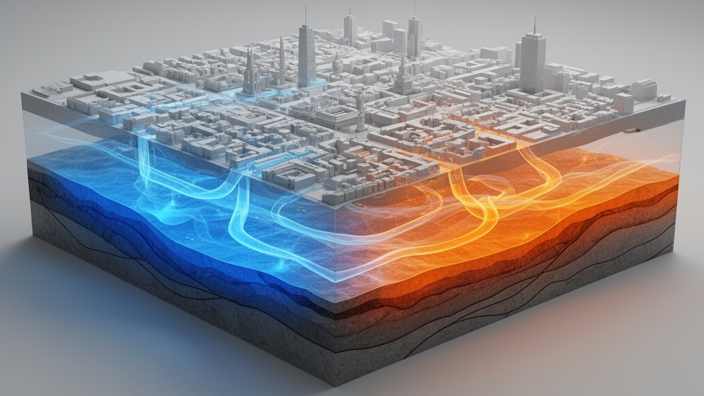
A high-resolution computational study of the urban subsurface beneath central Berlin, Germany, has demonstrated how physics-based numerical simulations combined with machine learning decision trees can classify complex underground environments into distinct groundwater and geothermal archetypes. Researchers Mohammad Reza Hajizadeh Javaran, Monika J. Kreitmair, Nikolas Makasis, Philipp Blum, and Kathrin Menberg established a multi-tiered modeling workflow covering a 118-square-kilometer sector of the German capital to an overall depth of 250 meters. By linking detailed three-dimensional geological stratigraphy with steady-state groundwater flow and heat transport modeling, the team showed that the intricate thermodynamic signature of a major metropolis can be categorized into standardized structural profiles. These profiles successfully capture both regional temperature gradients and localized thermal anomalies driven by underground infrastructure, offering a computationally efficient pathway for municipal groundwater management and shallow geothermal system deployment.
Urban underground environments across the globe are progressively warming under the influence of the subsurface urban heat island effect, driven by dense construction and extensive surface sealing. Anthropogenic underground structures such as heated building basements, subterranean parking facilities, and railway transit tunnels continuously release thermal energy into shallow aquifers. Concurrently, natural hydrogeological conditions, including groundwater table depth, flow velocities, surface water bodies, and sediment thermal conductivity, govern the dispersion and accumulation of this subsurface heat. Because groundwater temperature plays a direct role in drinking water quality, chemical stability, and subterranean invertebrate ecosystems, accurate thermal mapping is critical for sustainable city planning. Furthermore, rising subsurface temperatures present a viable low-carbon energy source if extracted responsibly using ground source heat pump systems, requiring balanced tools that reconcile physical modeling accuracy with computational viability.
To capture the hydrogeological complexity of central Berlin without incurring the immense computational penalties of an unpartitioned city-scale simulation, the researchers constructed a three-dimensional geological model in Leapfrog Geo using 22 regional geological cross sections intersecting the study domain. The geological setting in the northeastern German basin comprises Weichselian glacial sands, extensive glaciofluvial meltwater deposits forming four primary freshwater aquifers, and glacial tills and marls across the Barnim and Teltow plateaus, underlain by Rupelian clay acting as a lower aquitard. The team split the 118-square-kilometer domain into a structured grid of uniform blocks, each measuring 500 meters by 500 meters horizontally and 50 meters in thickness. This spatial division yielded five vertical depth layers comprising 530 blocks per layer, forming a total volume of 2,650 individual block units extending from the ground surface down to 250 meters depth.
Parametrization of the uppermost layer from 0 to 50 meters below ground level integrated comprehensive geospatial inventories of built infrastructure alongside surface temperature variations. Data layers included building footprint coverage, underground car parks extending to 3 meters depth with an assigned constant internal temperature of 18 degrees Celsius, and train tunnels spanning depths from 6 to 18 meters at 18 degrees Celsius. Because individual heating statuses were unavailable across the city’s building stock, basements were assumed to penetrate 3 meters deep at a uniform average temperature of 15 degrees Celsius. Land use compositions were converted into annual mean ground surface temperatures by adding land-cover thermal offsets to Berlin’s long-term mean air temperature of 9.9 degrees Celsius, resulting in an area-wide average surface temperature of 12.3 degrees Celsius that closely matched regional satellite observations.
Individual block simulations of steady-state groundwater flow and thermal transport were subsequently executed in FEFLOW, utilizing hydraulic heads derived from official contour maps of the main drinking water aquifer. A directed connectivity graph mapped regional hydraulic head differences exceeding 0.5 meters between adjacent blocks, defining the directional sequence of fluid movement from northern and northeastern recharge boundaries toward central and southeastern sections. Within this framework, thermal discharges from basements, car parks, transit tunnels, and surface heat fluxes were applied as Cauchy boundary conditions through concrete heat transfer coefficients, while the deepest model layer was assigned fixed temperature boundaries between 15.1 and 16.4 degrees Celsius. The uppermost block models utilized fine spatial discretizations totaling 249,800 elements per block to resolve high-gradient thermal interfaces around structures, whereas deeper, infrastructure-free layers utilized 58,960 elements.
The simulated volumetric temperatures across the uppermost block layer revealed an average temperature of 13.4 degrees Celsius, exhibiting pronounced thermal anomalies in heavily built urban sectors. Thermal hot spots were simulated beneath the central Mitte district, the central railway station, and Alexanderplatz, where multi-layered train tunnels and high basement densities pushed average block temperatures to 14.3 degrees Celsius. Conversely, extensive vegetated reserves and open urban spaces, such as Tiergarten park, Tempelhofer Feld, and the former Tegel airport grounds, exhibited simulated low-temperature zones averaging 12.1 degrees Celsius. While large-scale spatial patterns showed close agreement with empirical maps interpolated from 2024 monitoring well observations, the numerical models predicted slightly higher temperatures than the empirical average of 12.8 degrees Celsius, primarily because monitoring wells are predominantly situated within roadside green corridors rather than directly adjacent to subterranean heat sources.
Beneath the shallow zone, simulated volumetric temperatures in deeper strata progressively decoupled from surface land use and conformed to regional geothermal conduction. In the 50 to 100 meter depth layer, volumetric temperatures ranged between 12.0 and 14.6 degrees Celsius, reflecting residual advective and conductive heat propagation from overlying structures. However, spatial heterogeneity steadily attenuated through intermediate intervals of 100 to 150 meters and 150 to 200 meters. By the deepest evaluated interval between 200 and 250 meters, volumetric temperatures converged into a highly uniform range spanning 14.8 to 16.0 degrees Celsius. This stabilization was largely driven by the dense Rupelian clay layer, whose low hydraulic conductivity of 1.0 multiplied by 10 to the negative ninth meters per second strictly inhibits lateral convective heat transport and buffers deeper aquifers against surface-induced thermal plumes.
To categorize these extensive simulation outputs into actionable planning units, the research team applied regression-based decision tree algorithms that iteratively split the input-output parameter space by minimizing the mean squared error of volumetric temperatures. For the anthropogenically altered shallow layer between 0 and 50 meters depth, the decision tree analysis identified 38 distinct groundwater archetypes under an intermediate tolerance threshold, retaining a very low node impurity between 0.05 and 0.13 degrees Celsius. Feature importance evaluations confirmed that heated basements represented the single most influential explanatory driver across shallow archetypes, followed by groundwater head differences, upstream boundary temperatures, ground surface temperatures, and effective sediment porosity. Zero importance assigned to thermal conductivity reflected collinearity with heat capacity during decision tree branching.
For the deeper, infrastructure-free domain between 50 and 250 meters depth, the regression tree algorithm converged on 21 distinct groundwater archetypes at an optimized error tolerance of 0.0002. In these deeper units, upper boundary temperatures and lower geothermal boundary conditions completely governed archetype differentiation, as lithological properties remained largely homogeneous across regional stratigraphic formations. Across tested shallow cluster resolutions ranging from 10 to 82 archetypes, the mean domain-wide volumetric temperature remained unchanged at 14.4 degrees Celsius, demonstrating that grouping urban blocks into standardized archetypes preserves broad spatial thermal structures while filtering out stochastic noise and enabling rapid scenario evaluation.
To demonstrate direct utility for municipal energy planning, the researchers filtered the 38 shallow groundwater archetypes into 10 geothermal archetypes, designated AGeo1 through AGeo10, ranked by increasing volumetric temperature and solid-phase thermal conductivity. Archetypes qualified for closed-loop ground source heat pump utilization if their simulated volumetric temperature exceeded 13.0 degrees Celsius and average thermal conductivity surpassed 1.5 watts per meter-Kelvin. Crucially, blocks possessing greater than 25 percent surface coverage of built infrastructure were excluded to reflect physical installation constraints in dense city quarters and current municipal regulations barring installations in public roadways. The resulting classification mapped prime locations for geothermal exploitation while transparently identifying regulatory overlaps with designated drinking water protection zones and underlying clay aquitard drilling restrictions.
The study authors emphasize that while the specific archetype classes reflect Berlin’s unique geological and infrastructural layout, the modular modeling methodology is universally transferable to other metropolitan regions with varying geological frameworks, such as karst aquifers or crystalline bedrock. The authors noted several key limitations, including the reliance on literature-derived infrastructure temperatures, idealized rectangular structural geometries, and the absence of direct, independent deep borehole validations within the initial geological interpolation. Future extensions of the archetype framework could integrate chemical solute transport to evaluate water quality impacts, incorporate shallow electrical resistivity tomography for geophysical model verification, and assimilate localized building heating demand data to optimize the spatial matching of geothermal supply and decarbonization requirements.
Subject of Research: Urban subsurface thermal modeling and groundwater geothermal archetype classification in Berlin
Article Title: Groundwater and geothermal archetypes in Berlin, Germany
Article References: Hajizadeh Javaran, M. R., Kreitmair, M. J., Makasis, N., Blum, P., & Menberg, K. (2026). Groundwater and geothermal archetypes in Berlin, Germany. Geothermal Energy, 14(1), Article 5. https://doi.org/10.1186/s40517-026-00375-8
Image Credits: AI Generated
DOI: 10.1186/s40517-026-00375-8
Keywords: groundwater archetypes, geothermal energy, subsurface urban heat island, ground source heat pumps, hydrogeology, thermal modeling, FEFLOW, Leapfrog Geo, Berlin subsurface, decision tree regression, urban aquifers, anthropogenic heat flux, groundwater temperature, shallow geothermal potential, aquifer thermal management, urban infrastructure heat
News Source: Denise Maddox. (November 16, 2026). Subsurface Models Identify Groundwater Archetypes for Geothermal Energy Across Berlin. Scienmag.