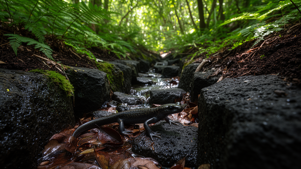
Published in Ecology and Evolution, a spatial modeling study reveals that neither macroscopic terrain features nor localized microenvironmental factors alone can fully account for where this terrestrial amphibian persists. Instead, broad-scale landscape networks spanning one kilometer or more establish an enduring geographical template, while localized forest canopy shading, slope exposition, and microtopographic hollows determine actual occupancy within that broader framework. By employing spatial block cross-validation to compare individual and combined models, researchers demonstrated that considering both spatial scales simultaneously provides a substantially more robust understanding of amphibian occurrence than traditional single-scale distribution assessments, illuminating how topographic persistence and microclimatic moisture refugia interact across isolated island ecosystems.
Standard species distribution models frequently rest on an implicit equilibrium assumption, presuming that a species currently occupies all geographic areas that meet its contemporary environmental requirements. However, this assumption rarely holds for organisms characterized by low dispersal capacity, extreme site fidelity, and profound physiological sensitivity to environmental fluctuations. Amphibians represent a classic non-equilibrium taxon because their permeable, cutaneous respiratory surfaces make them exceptionally prone to rapid desiccation, severely restricting movement across dry terrain. Salamanders in particular exhibit slow population expansion and strong fidelity to localized breeding wetlands and adjacent forest floors. Consequently, contemporary occurrences often reflect accumulated historical dispersal pathways, past geomorphological developments, and sustained hydrological stability rather than immediate climatic convenience. Within the biotic, abiotic, and movement framework, an organism’s accessible geographic area may remain considerably smaller than the total abiotically suitable territory, leaving physically suitable but historically unreachable habitats completely unoccupied.
Jeju Island offers an ideal closed geographic system to investigate these multiscale dynamics because its strict oceanic boundaries, preserved montane interior, and complex volcanic geomorphology create sharp environmental contrasts within a contained extent. The empirical foundation for the investigation was derived from systematic amphibian and reptile field records compiled during the Third National Ecosystem Survey by the Ministry of Environment of the Republic of Korea. Field observations across the island were documented in 2011 and 2013, yielding an initial raw dataset of 102 presence coordinates. To mitigate spatial autocorrelation and eliminate sampling bias stemming from clustered survey effort, the researchers implemented a greedy spatial thinning algorithm in R, enforcing a minimum nearest-neighbor distance threshold of 500 meters. This thinning retained 85 independent occurrence points, which were standardized in WGS84 and projected into EPSG:5179 alongside 10,000 randomly sampled background points across defined terrestrial land cells.
To evaluate environmental determinants at contrasting operational resolutions, the research team compiled spatial variables within Google Earth Engine, classifying them a priori into broad-scale and fine-scale predictor sets based on spatial extent and hypothesized environmental persistence. The broad-scale set contained 40 initial variables measuring terrain attributes at scales of one kilometer or greater, including elevation, topographic relief, slope standard deviation, and valley depth, alongside MERIT Hydro upstream drainage area and height above drainage. Hydrological persistence was further characterized using JRC Global Surface Water occurrence metrics and historical TerraClimate records spanning from 1958 through 2024. Conversely, the fine-scale set comprised 21 predictors operating at resolutions of 300 meters or less, capturing microtopographic slope, northness, eastness, topographic position indices, cold-air pooling, solar exposure, and MODIS vegetation indices alongside Hansen canopy metrics. Pairwise collinearity screening at a correlation threshold of 0.97 retained 24 broad-scale and 18 fine-scale predictors.
The core modeling framework relied on weighted binomial elastic-net logistic regression implemented via glmnet, which incorporates both L1 lasso shrinkage and L2 ridge penalties to handle high-dimensional collinear predictors effectively. Because presence-only ecological surveys lack confirmed absences, observation weights were calibrated so that occurrence points and background points received identical total weight, yielding an effective modeling prevalence of 0.5. To guard against inflated performance metrics caused by spatial autocorrelation, the investigators instituted a five-fold spatial block cross-validation scheme based on five-kilometer by five-kilometer grid blocks. During internal tuning, the elastic-net mixing parameter alpha was evaluated across candidate values, ultimately selecting 0.05 for the broad-scale model, 0 for the fine-scale model, and 0.10 for the combined model. To verify that algorithmic peculiarities did not drive their conclusions, the authors simultaneously trained MaxEnt models utilizing linear, quadratic, and hinge feature transformations across identical spatial cross-validation partitions.
When evaluated across spatial block validation folds, the broad-scale and fine-scale models exhibited nearly identical discriminatory capacity, achieving area under the receiver operating characteristic curve values of 0.787 and 0.782, respectively, with a statistically negligible difference of 0.004. However, the broad-scale model demonstrated superior predictive calibration and biological discrimination across gradient extremes, yielding a Tjur’s coefficient of discrimination of 0.163 compared to 0.122 for the fine-scale model, a lower log loss of 0.558 versus 0.586, and a continuous Boyce index of 0.929 compared to 0.643. Integrating both variable sets into a unified combined model yielded the strongest overall performance, elevating the receiver operating characteristic area to 0.809, the continuous Boyce index to 0.950, and Tjur’s R-squared to 0.199, while decreasing log loss to 0.527. Precision-recall area under the curve spanned from 0.051 to 0.062, representing a sixfold to eightfold improvement over the empirical prevalence baseline of 0.008.
Analysis of standardized regression coefficients revealed that drainage network position served as the primary environmental correlate of salamander occurrence across both analytical tiers. Within the broad-scale model, occurrence probability correlated positively with upstream contributing drainage area and one-kilometer topographic heterogeneity, displaying coefficients of positive 0.268 and positive 0.244, while decreasing markedly with relative vertical height above the nearest drainage axis at negative 0.161. In the fine-scale model, occurrence was positively associated with localized topographic wetness index values at positive 0.322 and negatively associated with topographic position indices at 90 meters and 300 meters, confirming a marked preference for concave hollows and valley bottoms. In the combined model, leading predictors remained balanced between broad-scale topographic heterogeneity, upstream drainage area, and fine-scale topographic position. This dual-scale alignment mirrors the life history of Hynobius quelpaertensis, whose terrestrial adults require damp forest substrates while migrating seasonally to connected aquatic valley wetlands for successful breeding.
To ascertain whether microhabitat parameters further refine occupancy patterns within broadly suitable territory, the researchers constructed a second-stage local model restricted to the broad-scale core, defined as areas meeting or exceeding the tenth percentile of broad-scale suitability at occurrence sites. Fitting a weighted binomial generalized additive model with thin-plate regression splines while incorporating logit-transformed broad-scale suitability as a fixed offset revealed that fine-scale microhabitat substantially improved local calibration. The local generalized additive model doubled Tjur’s R-squared from 0.138 in a recalibrated offset baseline to 0.283, lowered log loss from 0.592 to 0.493, and explained 33.1 percent of deviance. Partial response curves showed that occurrence probabilities increased steeply as the canopy shade index rose from 0.2 to 0.3, climbed steadily with increasing 300-meter valley depth, peaked at intermediate solar radiation levels, and dropped sharply on exposed south-facing slopes.
A joint classification based on tenth-percentile suitability thresholds categorized Jeju Island’s land surface into four distinct ecological zones. Class 1, representing areas with high suitability at both broad and fine scales, covered 38.1 percent of the land area and harbored 69 of the 85 confirmed salamander records, yielding a high presence rate of 18.5 occurrences per 1,000 background points. Class 2, defined by low broad-scale but high fine-scale suitability, encompassed 24.0 percent of the island yet contained only seven occurrence records, resulting in a presence rate of 3.0 per 1,000 background points. Class 3, marked by high broad-scale but low fine-scale suitability, represented 16.6 percent of land with seven occurrences and a presence rate of 4.1. Finally, Class 4, exhibiting low suitability across both scales, comprised 21.4 percent of the terrain with merely two records.
Spatial diagnostic testing confirmed that the empirical findings were not artifacts of unmodeled spatial patterns. Residual spatial autocorrelation across out-of-fold predictions remained exceptionally weak, with absolute Moran’s I values remaining below 0.016 across all tested models. While large sample sizes rendered small values of Moran’s I statistically detectable in the broad-scale model, combined model, and local core generalized additive model, these minimal magnitudes did not undermine model validity under rigorous spatial block validation. From an applied conservation perspective, the authors emphasize that safeguarding Hynobius quelpaertensis necessitates a dual-tiered management approach. Because 81 percent of documented occurrences fall within Class 1 habitats, conservation priorities must focus on protecting contiguous drainage corridors and interior montane valley networks from fragmentation. Furthermore, Class 2 zones, covering nearly a quarter of Jeju Island, represent critical candidate areas where targeted field surveys can distinguish whether the absence of detections reflects genuine dispersal barriers, historical demographic extirpation, or survey undercounting.
Despite its detailed spatial resolution, the investigation highlights several methodological limitations inherent to presence-only ecological modeling across isolated island environments. The occurrence data relied on historical surveys conducted in 2011 and 2013 without standardized repeated site visits, precluding the direct statistical estimation of detection probabilities and variable search effort. Additionally, environmental layers spanned disparate temporal windows, pairing multi-decadal historical climate metrics from 1958 through 2024 with contemporary forest cover and static elevation data. The coarse four-kilometer native resolution of TerraClimate variables also constrained island-wide microclimatic differentiation. Finally, because the study focused exclusively on Jeju Island’s isolated insular population, which genetic studies indicate underwent a founder effect, the observed spatial dynamics cannot be generalized directly to mainland populations in southwestern Korea. The researchers conclude that future investigations must integrate fine-scale population genetics, palaeoenvironmental reconstructions, and standardized mainland surveys to establish whether historical connectivity constraints or contemporary microclimates ultimately govern salamander survival across contrasting geographic landscapes.
Subject of Research: Spatial distribution modeling and multiscale habitat suitability of the Jeju salamander on Jeju Island
Article Title: Broad‐Scale Landscape Structure and Fine‐Scale Microhabitat Jointly Shape the Distribution of the Jeju Salamander, Hynobius quelpaertensis
Article References: Kim, J.-S., Park, J.-K., Lee, J.-E., & Do, Y. (2026). Broad‐Scale Landscape Structure and Fine‐Scale Microhabitat Jointly Shape the Distribution of the Jeju Salamander, Hynobius quelpaertensis. Ecology and Evolution, 16(11), Article e74661. https://doi.org/10.1002/ece3.74661
Image Credits: AI Generated
DOI: 10.1002/ece3.74661
Keywords: Hynobius quelpaertensis, Jeju salamander, species distribution models, spatial block cross-validation, elastic-net regression, generalized additive models, microhabitat buffering, drainage networks, upstream drainage area, canopy shade, topographic position index, topographic wetness index, non-equilibrium dynamics, candidate unoccupied habitat, Jeju Island, amphibian conservation, spatial autocorrelation, TerraClimate
News Source: Drew Townsend. (November 13, 2026). Drainage Structure and Shaded Microclimates Jointly Regulate Jeju Salamander Distribution. Scienmag.