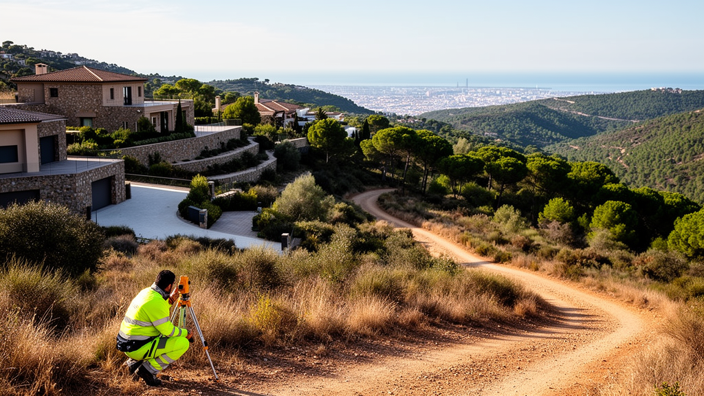
A comprehensive assessment of wildfire hazards in the mountain interface zones of Barcelona reveals that statistical vulnerability metrics and qualitative ethnographic fieldwork produce distinctly divergent understandings of community hazard susceptibility. Published in the journal Fire Ecology, the investigation demonstrates that standard vulnerability indices based on aggregated demographic and socioeconomic data frequently fail to capture how everyday infrastructural, physical, and institutional realities shape wildfire exposure. Researchers from an interdisciplinary project titled WUICOM-BCN brought three widely recognized municipal index frameworks into direct dialogue with fourteen months of situated ethnographic observation across mountain neighborhoods in the Collserola range. Their findings demonstrate that conventional indicator scores can assign low vulnerability ratings to affluent settlements where physical topography, road congestion, and regulatory constraints severely impede evacuation and fire suppression. Conversely, communities categorized as highly vulnerable due to lower income and aging populations often maintain robust informal care networks and spatial knowledge that bolster local emergency response capacities.
In recent decades, escalating wildfire danger has transformed the wildland–urban interface, or WUI, into a critical focus of hazards research and territorial planning across the globe. Broadly defined as zones where human settlements, buildings, and infrastructure intersect with or abut flammable wildland vegetation, interface areas are conventionally examined through biophysical parameters such as vegetative fuel loads, local topography, ambient weather conditions, and modeled fire behavior. However, hazards researchers have increasingly emphasized that disaster risks are equally determined by complex social dimensions, including institutional practices, community cohesion, and uneven socioeconomic conditions that dictate how populations experience, withstand, and recover from fire incidents. To translate these human dimensions into actionable planning policies, disaster agencies have widely relied on social vulnerability indices that synthesize census tracts and demographic datasets into spatial maps. While these numerical models provide standardized comparisons across broad metropolitan regions, critical scholars have cautioned that they risk treating vulnerability as an unvarying, static property of populations rather than an active, emerging process.
To investigate how different analytical methodologies generate distinct forms of hazard knowledge, the research team focused on the complex peri-urban terrain of Barcelona’s Collserola natural park, a forested mountain massif designated as a protected natural area in 2010. The Collserola interface features settlements marked by steep gradients, convoluted access roads, and historical legacies of dispersed residential expansion and informal urbanization. Within the wider WUICOM-BCN research initiative, which operated between 2021 and 2023, investigators from risk engineering, landscape architecture, and the social sciences initially mapped nine distinct Areas of Interest across the metropolitan wildland–urban interface. These designated zones included Vallvidrera, Torre Baró, Ciutat Meridiana, Mas Sauró, Mas Guimbau, Tibidabo, Mundet, Can Rectoret, and Sant Genís dels Agudells. Spanning a diverse spectrum of settlement typologies from consolidated urban fabrics to low-density, dispersed dwellings embedded in dense woodlands, the project selected Can Rectoret and Sant Genís dels Agudells for in-depth comparative investigation.
The quantitative phase of the research drew upon municipal and metropolitan datasets by analyzing three distinct instruments: the Social Vulnerability Index (SVI), the Urban Vulnerability Index (UVI), and the Residential Vulnerability Index (RVI). The Social Vulnerability Index emphasizes demographic structures, focusing primarily on population aging, income levels, and migratory composition at the census-tract level. The Urban Vulnerability Index expands this scope by incorporating broader built-environment attributes, evaluating rental market trends, structural building conditions, age of properties, and residential density at the metropolitan statistical area scale. Meanwhile, the Residential Vulnerability Index concentrates directly on architectural quality, housing dynamics, and physical building stability in relation to household socioeconomic conditions. To establish methodological comparability across discordant geographic reporting units, the researchers normalized every indicator score onto a standardized continuous scale ranging from one to ten, which was subsequently grouped into low, intermediate, and high vulnerability classifications to facilitate interdisciplinary technical discussion.
When applied to the primary case study communities, these standardized indices generated striking and partially contradictory vulnerability profiles across different analytical dimensions. Can Rectoret, an intermix settlement characterized by detached, low-density residences interspersed directly with flammable forest vegetation, recorded a minimal score of 1 out of 10 on both the Social Vulnerability Index and the Urban Vulnerability Index. This aggregate score portrayed Can Rectoret as exceptionally resilient due to its comparatively high household incomes, low unemployment rates, and elevated educational attainment. However, when assessed through the Residential Vulnerability Index, Can Rectoret’s score spiked to 8.2 out of 10, highlighting severe structural deficits in local residential conditions, built environments, and housing dynamics. In sharp contrast, Sant Genís dels Agudells, a densely built neighborhood situated along adjacent forested ravines, registered elevated vulnerability scores of 6.57 on the Social Vulnerability Index and 8 on the Urban Vulnerability Index, reflecting an older population base, lower mean household earnings, and higher unemployment. Yet on the Residential Vulnerability Index, its score moderated to an intermediate 5.32, a divergence potentially influenced by targeted public investments from the municipal Pla de Barris urban regeneration program.
While numerical indices established broad macro-level metropolitan patterns, fourteen months of intensive ethnographic fieldwork conducted by the social science team revealed the grounded realities governing how vulnerability operates in practice. Through immersive participant observation, repeated field visits, and thirty-three semi-structured qualitative interviews with local residents, neighborhood association representatives, municipal technicians, and professional emergency personnel, the researchers traced the daily socio-material configurations of hazard. In lived reality, wildfire risk rarely surfaced as an isolated hazard; instead, it presented as deeply intertwined with day-to-day challenges of steep mountain topography, public service access, aging, and physical isolation. For elderly residents in Sant Genís dels Agudells, advanced age was not merely an abstract census category but a condition shaped by arduous, inclined streets and fractured urban layouts. Seniors who once walked into town found themselves physically homebound, dependent on small neighborhood buses, assisted by sympathetic transit drivers, and cut off from civic facilities like the Can Rectoret Civic Centre whose uphill access routes exclude those with reduced physical mobility.
Ethnographic inquiry brought to light critical dimensions of vulnerability that remain almost entirely invisible within statistical hazard indices, most notably vehicular mobility and road transit infrastructure. In both mountain settlements, historical urbanization over steep, irregular geography has established a convoluted network of narrow, winding lanes lacking proper pedestrian sidewalks. In these settings, private vehicle ownership functions as an indispensable life support system for purchasing groceries, reaching healthcare services, and maintaining contact with city services. Consequently, widespread vehicle dependence forces residents to park along tight roadsides and curbs, severely narrowing passage corridors. During emergency scenarios, this everyday parking practice creates dangerous spatial bottlenecks that impede essential municipal services. Field interviews documented real-world emergencies where responding fire engines were completely unable to negotiate the steep, obstructed switchbacks, while emergency technicians warned that two passing passenger vehicles frequently gridlock routes, rendering the timely arrival of ambulances or heavy fire suppression apparatus physically impossible.
Infrastructural maintenance and administrative conflicts emerged as another defining dimension of localized vulnerability that evaded indicator-based models. Within the contact zone between residences and the natural park, living amid mountain terrain requires perpetual vegetation management, clearance of overhead power lines, repair of road surfaces damaged by subterranean tree roots, and mitigation of wild boar disturbances and slope erosion. Residents described enduring feelings of municipal neglect, arguing that administrative authorities fail to recognize that families living within a protected natural forest require tailored municipal maintenance support. This friction is exacerbated by rigid territorial zoning regulations. Ethnographers documented cases where residential plots containing existing dwellings were officially designated as protected forest land. Under these environmental classifications, municipal forestry authorities decline to clear vegetation because roads are deemed forest tracks, while homeowners face strict administrative bans prohibiting the reconstruction of their dwellings should a wildfire destroy them, creating severe regulatory uncertainty that actively disincentivizes localized fuel abatement.
Crucially, the qualitative field observations demonstrated that conditions typically classified as social vulnerability frequently coexist with powerful, self-organized community coping capacities and mutual assistance systems. In Can Rectoret, residents organized informal communication channels through messaging applications such as WhatsApp to monitor environmental hazards, coordinate responses, and compensate for bureaucratic limitations. Drawing upon deep, unmapped spatial knowledge of their labyrinthine streets, community networks actively identify isolated elderly neighbors who lack private transportation and maintain coordinated vehicle pools ready to conduct evacuations during emergency confinement orders. Rather than confirming conventional analytical models that position social vulnerability and community resilience as mutually exclusive opposites, the empirical data prove that mutual assistance, localized ecological awareness, and civic initiative emerge from the very same socio-material configurations that generate everyday hazard vulnerability, enabling socioeconomically disadvantaged or isolated groups to mount sophisticated collective emergency actions.
The study authors emphasize that their comparative findings should not be interpreted as an argument to abandon statistical indices or treat ethnography as a corrective tool designed to recalibrate numerical models. Instead, they demonstrate the epistemic value of maintaining standardized indicators and qualitative inquiry in a productive, iterative dialogue. While statistical indices provide a rapid, standardized language essential for comparing wide metropolitan territories and coordinating interdisciplinary dialogues between engineers, architects, and public planners, ethnographic fieldwork slows analysis down to examine how material infrastructure, regulatory friction, and community arrangements operate locally. The researchers note that because their qualitative fieldwork focused specifically on Can Rectoret and Sant Genís dels Agudells, its localized insights cannot be directly extrapolated across all nine metropolitan interface areas. Consequently, wildfire governance must transition toward layered assessment frameworks where broad macro-level indicators are routinely combined with targeted interviews, participatory community mapping, and local stakeholder workshops to craft flexible, operationally relevant disaster preparedness strategies.
Subject of Research: Methodological dialogue between statistical vulnerability indices and ethnographic fieldwork in wildfire risk assessment
Article Title: Rethinking social vulnerability in the wildland–urban interface: an iterative dialogue between ethnography and vulnerability indices in Barcelona
Article References: Rodríguez-Giralt, I., & Cifre-Sabater, M. (2026). Rethinking social vulnerability in the wildland–urban interface: an iterative dialogue between ethnography and vulnerability indices in Barcelona. Fire Ecology, 22(1), Article 174. https://doi.org/10.1186/s42408-026-00606-0
Image Credits: AI Generated
DOI: 10.1186/s42408-026-00606-0
Keywords: wildfire risk, wildland-urban interface, social vulnerability, ethnography, vulnerability indices, Barcelona, disaster management, urban planning, Rethinking, social, vulnerability, wildland
News Source: Drew Townsend. (November 10, 2026). Barcelona Wildfire Study Shows Vulnerability Indices Miss Local Mountain Interface Realities. Scienmag.