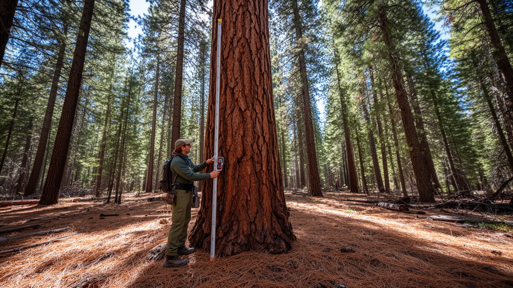
Differences in how scientists and land managers measure canopy base height can dramatically alter predictions of crown fire risk in western conifer forests, according to a methodological review and field investigation published in Fire Ecology. Researchers evaluated multiple measurement techniques across ninety-three undisturbed field plots in northern New Mexico and discovered that canopy base height estimates for the same forest stands varied by an average of six meters between methods. When these disparate structural estimates were entered into standard fire behavior models, the resulting predictions for the open wind speed required to initiate crown fire differed across methods by an average within-plot range of fourteen kilometers per hour. These findings indicate that calculated wildfire hazard is heavily determined by analytical method choice rather than intrinsic stand conditions alone.
Canopy base height represents the lowest vertical point in a forest stand where aggregated tree foliage and fine branch material are dense enough to propagate fire upward from the forest surface into the upper canopy. The metric is fundamentally distinct from tree-level crown base height, which measures the lowest live branch of an individual tree. Operational fire behavior systems, including widely used tools like FlamMap, FARSITE, and BehavePlus, rely directly on canopy base height alongside foliar moisture content to predict the critical surface fire intensity needed for upward flame transition. Within this modeling framework, the torching index defines the twenty-foot open wind speed required to trigger crown fire transition, while the crowning index defines the open wind speed necessary to maintain continuous fire spread throughout the canopy layer.
To investigate the operational consequences of varying measurement techniques, the research team reviewed direct and indirect estimation approaches and applied them across four dominant forest types in northern New Mexico. The study area encompassed 4.16 million hectares across the Santa Fe, Carson, Cibola, Rio Grande, and San Juan National Forests, spanning an elevational gradient from 1,500 to 4,000 meters. The examined ecosystems included pinyon-juniper woodlands at lower, arid elevations, middle-elevation ponderosa pine forests, mixed conifer stands dominated by Douglas-fir and white fir, and high-elevation, mesic spruce-fir forests. Within the ninety-three field plots, field crews measured every live tree with a diameter at breast height of at least five centimeters, recording species, diameter, total height, and crown base height using laser rangefinders and clinometers.
Direct field methods characterized canopy base height by summarizing individual tree crown base heights using distinct mathematical statistics, including the arithmetic mean, median, twentieth percentile, and stand minimum. In addition, the researchers processed the inventory data through the Forest Vegetation Simulator Fire and Fuels Extension to simulate vertical canopy bulk density bins of 0.3 meters. Under this modeling framework, canopy base height is defined as the lowest height where canopy bulk density exceeds a threshold of 0.011 kilograms per cubic meter across a running average of three bins, representing horizontal spread capacity rather than vertical initiation. FVS-FFE simulations were executed twice: once incorporating observed field crown ratios and once using the software’s internal equations that predict crown dimensions from stand-level basal area, diameter, and tree height.
Remote sensing workflows introduced additional layers of analytical variation through discrete-return airborne Lidar and spaceborne sensor modeling. The researchers processed USGS 3DEP airborne Lidar point clouds collected in 2016 and 2017 with an average density of six points per square meter. Because point density was often insufficient to sample lower branches directly across every tree, individual crown base heights were directly extracted for fourteen percent of trees using fuel layer identification algorithms and then predicted across remaining trees using localized height-to-base relationships before aggregating to plot metrics. Separately, satellite-derived estimates were evaluated using the national 2023 LANDFIRE product as well as a Google Earth Engine random forest model trained on airborne Lidar point samples combined with Sentinel-1 radar backscatter and Sentinel-2 multispectral imagery.
Statistical comparisons revealed pronounced discrepancies among the fifteen evaluated canopy base height metrics across all ninety-three study sites. Direct aggregations followed a descending pattern where the mean exceeded the median, twentieth percentile, and minimum values. The most conservative stand estimates across all plots were produced by field-measured minimum crown base height, averaging 0.63 meters, and LANDFIRE raster products, averaging 0.64 meters, which did not differ significantly from each other. In contrast, the satellite-based random forest models generated significantly higher average values of 4.82 meters. Airborne Lidar estimates also systematically exceeded field measurements by an average of 1.07 meters, reflecting the difficulty airborne lasers face in penetrating dense overstory canopies to detect suppressed understory foliage, as well as an imposed 0.5-meter algorithm cutoff to eliminate ground noise.
These structural measurement discrepancies directly translated into severe divergences when researchers simulated fire behavior using the firebehavioR modeling package under standardized extreme drought conditions. Holding surface fuel models and weather constant while varying canopy base height caused predicted torching indices to vary by an average within-plot range of fourteen kilometers per hour. Field minimum crown base height yielded an average torching index of 0.3 kilometers per hour, whereas the satellite random forest predictions generated an average torching index of twelve kilometers per hour. Because the mathematical relationship between canopy base height and required torching wind speed is positive and non-linear, variability across methods was even greater for modeled torching indices than for the baseline fuel height measurements, exhibiting an average coefficient of variation of eighty percent compared to seventy percent.
Forest structural complexity played a decisive role in governing the magnitude of disagreement among characterization methods. When researchers analyzed the relationship between within-plot tree height variability and among-method canopy base height variability, they found strong positive linear associations in spruce-fir, ponderosa pine, and mixed conifer stands. Mixed conifer forests exhibited the widest absolute within-plot range among methods at 7.11 meters, while pinyon-juniper woodlands showed the highest relative variability proportional to total tree height, with a coefficient of variation of twenty-nine percent against fifteen percent in taller forest types. In uneven-aged stands where short ladder trees grow beneath a tall overstory, summary statistics diverge sharply, and overhead remote sensors frequently fail to register the low-lying foliage.
The study authors highlighted several methodological limitations that provide important context for interpreting the results across broader management landscapes. Field sampling was restricted entirely to federally managed national forest lands, excluding private timberlands that comprise eighteen percent of the regional forested area and typically feature more uniform, even-aged stands where method divergence would likely be smaller. Furthermore, spatial and temporal mismatches occurred between the datasets, as the airborne Lidar and Sentinel imagery dated from 2016 and 2017 while ground plots and LANDFIRE data reflected 2023 conditions, although disturbed plots were screened out. The authors emphasized that canopy base height is an operationally defined parameter rather than an absolute physical constant, meaning that divergence among methods represents structural sensitivity rather than simple measurement error.
These findings carry immediate practical consequences for wildland fire operations, prescribed burning, and fuel reduction treatment design. During emergency wildfire suppression, underestimating crown fire initiation risks firefighter safety, making conservative metrics like minimum crown base height appropriate for risk-averse tactical planning. Conversely, applying overly conservative canopy base height estimates to prescribed fire planning can unrealistically inflate predicted fire hazards, artificially narrowing burn prescription windows and restricting beneficial management.
Subject of Research: Canopy base height measurement methods and crown fire modeling sensitivity
Article Title: Methods and implications of canopy base height characterization for modeling crown fire potential
Article References: Mast, C. N., Vallet, L., Hurteau, M. D., Zald, H. S. J., Jones, G. M., Woolsey, G. A., Tinkham, W. T., Hoffman, C. M., & Francis, E. J. (2026). Methods and implications of canopy base height characterization for modeling crown fire potential. Fire Ecology, 22(1), Article 117. https://doi.org/10.1186/s42408-026-00567-4
Image Credits: AI Generated
DOI: 10.1186/s42408-026-00567-4
Keywords: canopy base height, crown fire, fire behavior modeling, torching index, wildfire risk, forest structure, airborne lidar, LANDFIRE, fuel management, forestry, Methods, implications
News Source: Drew Townsend. (November 10, 2026). Canopy Base Height Measurement Methods Significantly Alter Modeled Crown Fire Hazards. Scienmag.