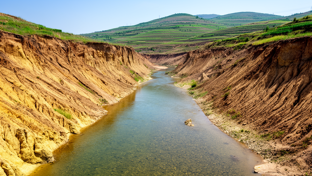
Researchers analyzing six decades of hydrological data from the Beiluo River Basin have determined that anthropogenic activities are the primary driver behind significant reductions in both streamflow and sediment load across the Loess Plateau. Published in Ecological Processes, the study reveals that while climate variables such as precipitation play a role, human-induced changes to the underlying surface conditions have exerted a much stronger influence on hydrological and sediment transport processes. The investigation focuses on three distinct geomorphic units within the basin, demonstrating that the pathways linking environmental drivers to water and sediment dynamics vary significantly depending on local terrain and landform characteristics.
The Beiluo River Basin, situated in northern China, is a major source of coarse sediment and a critical area for understanding soil erosion and water resource management. The basin covers an area of 26,900 square kilometers and features typical Loess Plateau landforms, including hilly gully regions, tableland gully regions, and terrace plain regions. These geomorphic units differ substantially in elevation, slope, and soil properties, which leads to variations in erosion intensity and sediment supply. By examining these distinct units, the study aims to clarify how water and sediment responses differ under varying geomorphic conditions, a factor that previous basin-scale studies have often overlooked.
To investigate these dynamics, the research team utilized hydrological records from three representative stations: Liujiahe, Jiaokouhe, and Zhuangtou. These stations correspond to the hilly gully (HG), hilly gully–tableland gully (HTG), and hilly gully–tableland gully–terrace plain (HTP) units, respectively. The data spans from 1962 to 2022, providing a long-term perspective on interannual changes. The study employed a combination of statistical methods, including the Mann–Kendall test for trend detection, the Pettitt test for identifying change points, and Double Mass Curves to assess data consistency. Additionally, Partial Least Squares Structural Equation Modeling (PLS-SEM) was used to quantify the direct and indirect relationships among precipitation, vegetation cover, land use, streamflow, and sediment load.
The analysis revealed that streamflow and sediment load at all three stations declined significantly over the study period, with statistical significance at P < 0.01. Abrupt changes in streamflow were detected in 2002, 1996, and 1994 for the Liujiahe, Jiaokouhe, and Zhuangtou stations, respectively. Following these change points, average streamflow decreased by 1.13 × 10⁸ cubic meters, 1.29 × 10⁸ cubic meters, and 2.62 × 10⁸ cubic meters compared to the pre-change periods. Similarly, sediment load exhibited abrupt changes around 2002, with post-change mean values reduced by 0.57 × 10⁸ tons, 0.62 × 10⁸ tons, and 0.69 × 10⁸ tons. These findings indicate a long-term trend of hydrological and sedimentary decline that is consistent across the different geomorphic units.
Despite the overall decline, the study found that the driving factors behind these changes were not uniform across the basin. In the HG unit, precipitation and streamflow did not show significant statistical relationships with sediment load. However, in the HTG and HTP units, precipitation showed a significant direct positive impact on streamflow. The PLS-SEM results highlighted that vegetation cover had a significant direct negative effect on streamflow in all three units, with path coefficients ranging from -0.323 to -0.644. Regarding sediment load, vegetation cover showed a significant direct negative effect in the HTG and HTP units, but this direct pathway was not significant in the HG unit, suggesting that other factors, such as gully erosion, may play a more dominant role in sediment production in the hilly gully area.
Land use changes also emerged as a critical factor, primarily influencing water and sediment dynamics through indirect pathways. The study found that land use affected streamflow and sediment load mainly by influencing vegetation cover and streamflow. In the HG unit, cultivated land and water bodies showed positive correlations with both streamflow and sediment load, while forest, grassland, and built-up land displayed negative correlations. In the HTG and HTP units, cultivated land was significantly positively correlated with sediment load, whereas forest and built-up land showed significant negative correlations. These patterns suggest that the conversion of cultivated land to forest and grassland, a key component of ecological restoration programs, has contributed to the reduction in sediment yield.
Quantitative attribution analysis indicated that human activities were the dominant contributor to the observed reductions. In the HG unit, human activities accounted for 110.71% of the decrease in streamflow and 98.28% of the drop in sediment load, with precipitation contributing a negative percentage, indicating an opposing effect. In the HTG unit, human activities contributed 86.05% to streamflow reduction and 98.38% to sediment reduction. In the HTP unit, human activities accounted for 78.63% of streamflow reduction and 100.02% of sediment load decrease. The fact that human activity contributions exceeded 100% in some units reflects the relative decomposition method used, where anthropogenic effects offset the positive influence of precipitation variability. This underscores the magnitude of the impact that land management and engineering interventions have had on the basin’s hydrology.
The study also highlighted the role of specific human interventions, such as check dams, terraces, and reservoirs, in regulating water and sediment. Check dams, which are widely distributed in the HG unit, intercept runoff and trap sediment, contributing significantly to the reduction in sediment load. Terraces reshape micro-topography and increase infiltration, further reducing surface runoff. Reservoirs intercept sediment and regulate downstream water discharge, while water extraction for agricultural and urban use reduces overall streamflow. These combined effects of ecological restoration and infrastructure development have fundamentally altered the hydrological regime of the Beiluo River Basin.
Limitations of the study include the reliance on long-term observational data, which may not fully capture event-scale erosion responses triggered by extreme rainfall. The PLS-SEM model, while effective for identifying pathway relationships, has limited capacity to represent nonlinear interactions and feedback mechanisms. Additionally, soil indicators were not included in the model due to limited interannual variability, and channel erosion processes such as bank erosion were not explicitly quantified. These factors introduce some uncertainty into the interpretation of sediment dynamics, particularly in the downstream terrace plain region where sediment deposition and redistribution are complex.
Despite these limitations, the findings provide valuable insights into the spatial heterogeneity of hydrological and sediment responses in the Loess Plateau. By distinguishing the effects of different geomorphic units, the study offers a more nuanced understanding of how climate change and human activities interact to shape watershed processes. The results suggest that effective water resource management and ecological restoration strategies must account for local geomorphic conditions, as the drivers of water and sediment changes are not uniform across the basin. This approach can help optimize soil and water conservation efforts in erosion-prone regions, ensuring sustainable management of water resources and ecological stability in the Yellow River Basin.
Beyond its localized catchment dynamics, the study links these findings to the broader context of the Yellow River Basin, a region supporting nearly thirty percent of China’s population and thirteen percent of its agricultural production. Across the 680-kilometer span of the Beiluo River, the landscape exhibits distinct elevation gradients despite relatively uniform hillslope angles. The upstream hilly gully area reaches a mean elevation of 1,497 meters with an average slope of 3.58 degrees, declining to 1,376.6 meters and 3.52 degrees in the intermediate tableland gully zone, and down to 1,292.8 meters and 3.54 degrees across the lower terrace plain. Calcaric Cambisols constitute the predominant soil order throughout all three geomorphic divisions. Hydrological monitoring documented a cumulative downstream increase along the river corridor: mean annual runoff grew from 2.14 × 10⁸ cubic meters at Liujiahe to 4.39 × 10⁸ cubic meters at Jiaokouhe and 6.08 × 10⁸ cubic meters at Zhuangtou, while annual sediment discharge rose from 0.49 × 10⁸ tons to 0.56 × 10⁸ tons.
To establish these relationships across complex observational baselines, the researchers assembled multi-source datasets adhering to national water resources standards. Cross-sectional discharge was determined by multiplying the measured channel area by average vertical flow velocity, while suspended sediment concentrations were obtained through laboratory oven-drying of periodic water samples. To overcome temporal and spatial discrepancies among satellite platforms, the team reconstructed a standardized 250-meter vegetation index spanning from 1982 to 2023. A univariate pixel-wise linear regression model calibrated on monthly data between 2001 and 2015 was verified across ten thousand random sample points from 2016 through 2022, yielding an R-squared of 0.88, a root mean square error of 0.076, and a mean absolute error of 0.056.
This reconstructed vegetation record documented pronounced ecological recovery across the watershed following implementation of the Grain for Green Program, which converted over 16,000 square kilometers of cropland into forestland and grassland across the Loess Plateau after 1999. Regional vegetation displayed an increasing northwest-to-southeast gradient, with baseline mean vegetation indices of 0.39 in the hilly gully zone, 0.53 in the intermediate area, and 0.56 in the terrace plain. Greening proceeded fastest in the hilly gully terrain, rising at an annual rate of 1.6 percent, compared to 0.86 percent and 0.80 percent in the downstream units. Furthermore, land use assessments between 1990 and 2023 revealed contrasting structural trajectories: while cultivated land dropped continuously and forestland expanded, grassland area grew by 2.29 percent in the hilly gully unit but declined by 6.2 percent and 16.3 percent in the intermediate and lower plain divisions.
Basin precipitation averaged 531.45 millimeters annually between 1962 and 2022, ranging from 383.29 to 617.94 millimeters with strong synchrony across zones yet showing no statistically significant long-term trend. The structural equation framework confirmed that climate inputs were translated differently through each terrain type. Precipitation exerted significant direct positive impacts on streamflow in the tableland gully and terrace plain units, with path coefficients of 0.497 and 0.692, but lacked significant direct or indirect pathways in the hilly gully unit. Simultaneously, land use changes exerted significant indirect negative controls on streamflow via vegetation cover, producing path coefficients of -0.588 in the hilly gully, -0.303 in the intermediate, and -0.443 in the terrace plain units, alongside indirect reductions in sediment load ranging from -0.573 to -0.694.
Subject of Research: Spatiotemporal variations and driving factors of streamflow and sediment load across different geomorphic conditions in a sediment-laden river of the Loess Plateau
Article Title: Spatiotemporal variations and driving factors of streamflow and sediment load across different geomorphic conditions in a sediment-laden river of the Loess Plateau
Article References: Li, X., Kong, F., Wang, H., Guo, J., & Tian, Y. (2026). Spatiotemporal variations and driving factors of streamflow and sediment load across different geomorphic conditions in a sediment-laden river of the Loess Plateau. Ecological Processes, 15(1), Article 79. https://doi.org/10.1186/s13717-026-00741-1
Image Credits: AI Generated
DOI: 10.1186/s13717-026-00741-1
Keywords: Spatiotemporal, variations, driving, factors, streamflow, sediment, load, across, different, geomorphic, conditions, sediment-laden
News Source: Violet Maxwell. (November 8, 2026). Human Activity Drives Sediment Decline in Loess Plateau River. Scienmag.